Before Russell County
Long before Russell County was established in 1825, this area functioned as part of a much larger frontier landscape shaped by waterways rather than political boundaries. The Cumberland River and its tributaries formed natural corridors for travel, trade, and settlement, linking this region to interior Kentucky and to communities far downstream into present-day Tennessee. Movement through the area followed river routes, creek valleys, and established paths rather than fixed county lines.
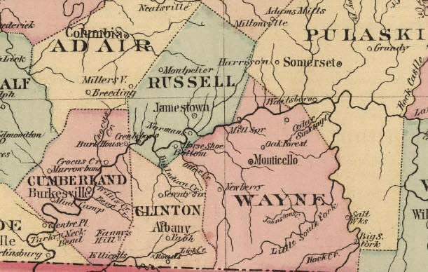
Source: David Rumsey Map Collection
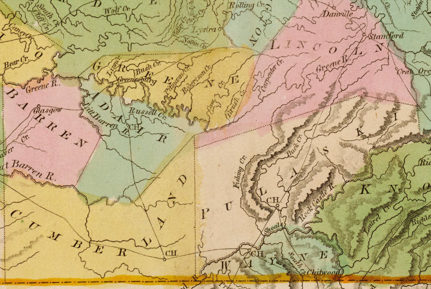
Prior to county formation, land that would become Russell County lay within portions of Adair, Cumberland, and Wayne Counties. Early settlers often appear in the records of those counties even when they were living on land that later fell inside Russell County boundaries. Deeds, tax lists, marriage bonds, and probate records from the late eighteenth and early nineteenth centuries frequently reflect this reality, making parent-county research essential for understanding the area’s earliest families.
Settlement patterns were closely tied to river access, fertile bottoms, and transportation routes. Communities developed near river landings, fords, and creek mouths, where goods and people could move more easily than across rugged interior terrain. These early neighborhoods often existed decades before formal county government arrived, leaving behind scattered records that document a lived-in landscape well before Russell County had a name.
When Russell County was finally created in December 1825, it formalized boundaries around communities that were already established. Understanding the area before county formation helps explain why early records seem fragmented and why families may appear to cross county lines repeatedly without ever truly relocating. The land was settled first; the county came later.
After County Formation
When Russell County was established in December 1825, it formalized boundaries around communities that were already functioning as neighborhoods, trade points, and family clusters. The creation of county government brought courts, record keeping, and local administration closer to residents who had previously depended on parent counties for legal and civic needs. This shift did not create settlement so much as organize it, anchoring long-standing patterns of landholding, kinship, and movement within a new political framework.
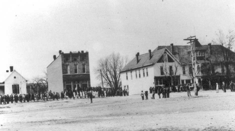
Jamestown emerged as the county seat and quickly became the center of official life. The town, first called Jacksonville, in honor of President Andrew Jackson, was incorporated on December 23, 1827. When the local Anti-Jacksonian Party came into power in 1826, the community was renamed Jamestown to honor James Wooldridge, donor of the one hundred acre town site.
Three Russell County courthouses were built between 1826 and 1978. During the Civil War, Jamestown was the site of two recorded skirmishes; one on Christmas Day, 1861, and the second on June 2, 1863.
While Jamestown served as the governmental center, river communities such as Creelsboro retained economic and social importance well into the nineteenth century. Positioned along the Cumberland River, Creelsboro remained connected to trade routes and travel patterns that extended far beyond the county itself. Families associated with the river often appear in records across multiple counties and sometimes far downstream, reminding researchers that Russell County’s history after formation continued to be shaped as much by waterways as by courthouse walls.
Namesake: Col William Russell III
Russell County, Kentucky was named in honor of Colonel William Russell III. He was born in Culpepper County, Virginia to William Russell and Tabitha (Adams) Russell. William Russell, Sr., was a prominent citizen of southwestern Virginia and a colonel in the Continental Army during the American Revolutionary War. In 1773, the elder Russell took his family, including William Jr., westward in the first attempt by British colonists to establish a permanent settlement in Kentucky.
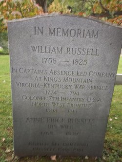
The expedition, guided by Daniel Boone, was abandoned after an attack by American Indians. Boone's son James and Henry Russell, brother of William Russell, Jr., were captured and tortured to death in the attack. During the Revolutionary War, William Russell, Jr., fought as a captain in the Virginia militia, taking part in the Battle of Kings Mountain as an aide to Colonel William Campbell.
After the war he relocated to Kentucky, settling in 1783 in Fayette County on land that had been granted to his father for military service. He served as a colonel of Kentucky militia in the Northwest Indian War. During the War of 1812, he was colonel of the 7th Infantry Regiment, taking part in the Siege of Fort Harrison and the Peoria War.
Russell served in the Virginia state House of Representatives in 1790 and 1791 and in the Kentucky house in 1792, 1796-1780, 1802, and 1823. Russell County, Kentucky is named for him, but Russellville, Kentucky and Russell County, Virginia are named for his father.
Source: Robert M. Rennick, Kentucky Place Names (University Press of Kentucky, 1988), p. 259. The Kentucky Encyclopedia.