Repositories & Records
The
Elliott County Courthouse in Sandy Hook holds surviving county-level records.
The Elliott County Clerk maintains land and marriage records, while the
Office of the Circuit Court Clerk
oversees court case files. Because of record loss, many Elliott County materials
are fragmentary. Microfilm copies and related collections are available through the
Kentucky Department for Libraries and Archives (KDLA).
The Rocky J. Adkins Public Library in Sandy Hook
may offer other useful local records. The Elliott County Historical Society would also be worth a visit.
Because Elliott is bordered by multiple counties and includes long-established communities near county
lines, researchers should also use nearby repositories and surrounding county collections for connected
families. Regional newspapers, church minutes, cemetery readings, and local history publications for
Warren,
Hart, Grayson, Butler, and Barren Counties can be especially helpful.
Notes
Notes
Reconstructing Elliott County families:
Elliott County research often depends on assembling family groups indirectly.
Because early volumes were lost and record-keeping was inconsistent, individual
documents rarely stand alone. Instead, track families across tax lists, later deed
books, census schedules, and repeated court appearances to establish continuity.
Neighborhood-based research:
Families in Elliott County settled by creek, fork, and ridge rather than by town.
Study neighbors closely—witnesses, bondsmen, road hands, and jurors frequently
represent extended family networks. Mapping households by census order can be more
informative than searching by surname alone.
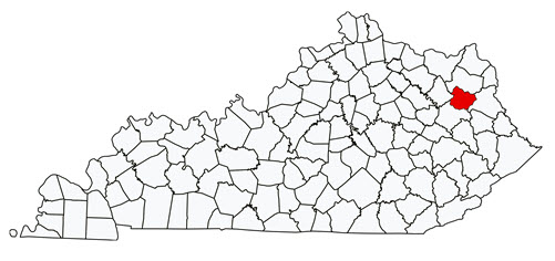
Parent-county substitution:
For events before and after 1869, Carter, Lawrence, and Morgan Counties remain
essential. Marriages, probate actions, and land transactions often appear in those
counties even after Elliott’s formation. Do not assume absence from Elliott records
means absence from the area.
Land and tax strategy:
Land ownership was limited and often informal. Annual tax lists can be more reliable
than deeds for tracking residence and age progression. Watch for subtle changes in
acreage, watercourses, and district assignments rather than expecting clean legal
descriptions.
Community records:
Church minutes, cemetery readings, family Bibles, and oral histories are critical
sources. Many Elliott County families appear more fully in local manuscripts and
privately held records than in surviving courthouse material. Regional newspapers,
especially from Carter and Rowan Counties, frequently mention Elliott residents.
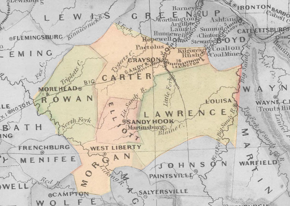
Map is from the 1891 Appleton Map of Kentucky.
Found in the David Rumsey Map Collection.