Zone 1 — Far northwest
School No. 39 · Pleasant View Church · M.E. South
- R. Dickens
- M. Dickens
- Wm Watkins
- Thos Harlow
- N. Land
- E. Land
- Res. Wm Dearinger
- R. H. Stivers
- L. Gordon
- C. Simmons
Franklin County, Kentucky — D. J. Lake & Co. atlas, 1882
Landowners, residents, schools, churches, and post offices read from the original plate. Color washes mark nine research zones. Click the map to enlarge. A question mark means the engraving was cramped or uncertain.
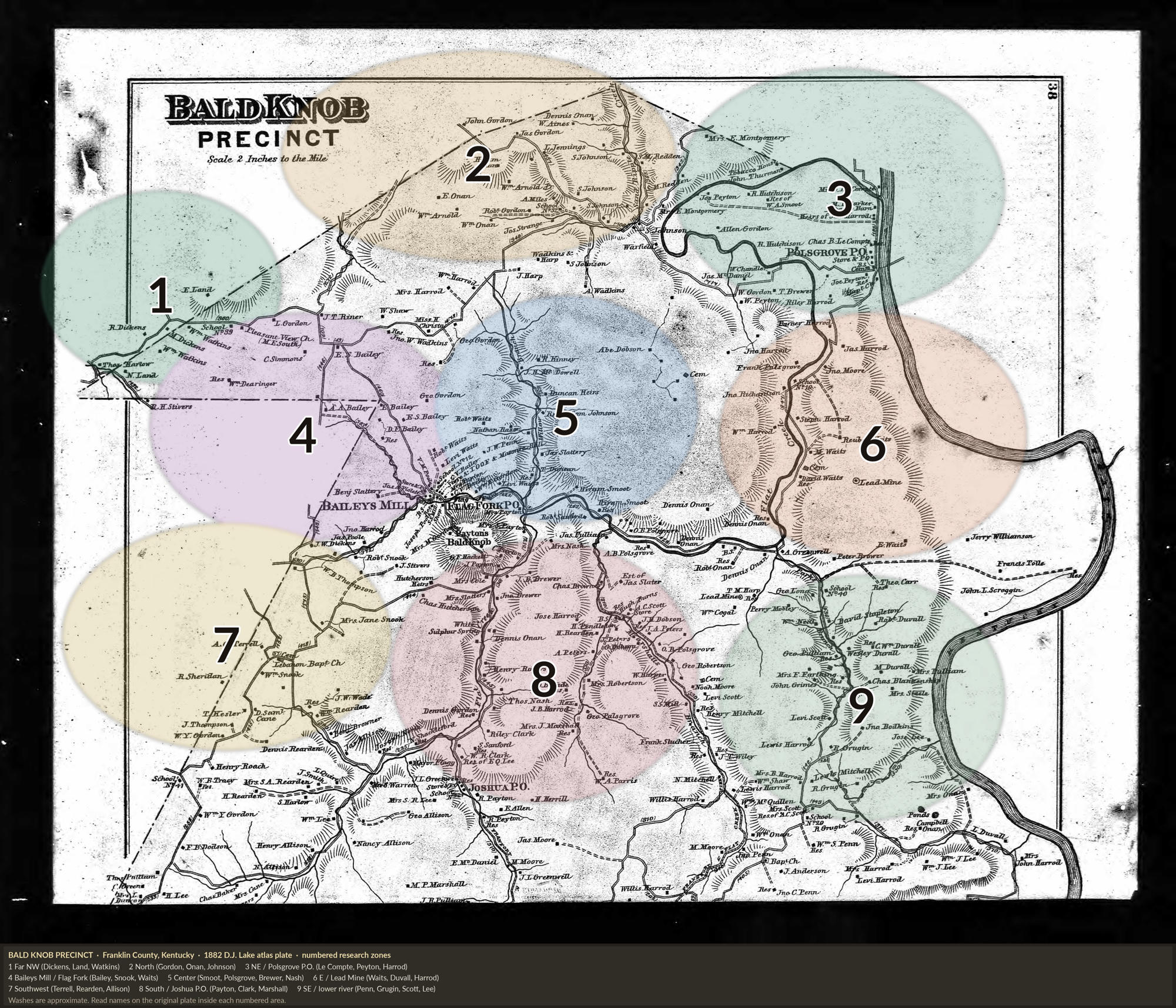
Washes are approximate guides. The engraved name on the plate is the authority. The same family can appear in more than one zone when they held several parcels.
School No. 39 · Pleasant View Church · M.E. South
Robt Gordon School
Polsgrove P.O. (store) · Tobacco House · School No. 18
Baileys Mill · Flag Fork P.O. · Bald Knob village
Cemetery
Lead Mine · School No. 40
Lebanon Baptist Church · School No. 41
Joshua P.O. · White Sulphur Spring
Baptist Church · School
Source: An Atlas of Franklin County, Kentucky, D. J. Lake & Co., 1882, from surveys under the direction of B. N. Griffing. Color zones added for research use.
Copy the citation below to include in your research notes or family tree software: