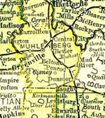
Muhlenberg County Kentucky
Cemeteries D
Driskill Cemetery
- Driskill, Furney Green. Died 17 June 1871. Lieut Co I 48th Ky Inf.
- Tate, Mary. Born 23 Nov 1806. Died 5 Apr 1882. Wife of R.B. Tate.
Location
Located on a gravel road, down a very steep hill from the end of Friendship Cemetery, about ½ mile to fork in road, turn left & cemetery is about 100 yards off road in a field.
GPS coordinates of Friendship Baptist Church: 37.16402, -87.19266.
According to Muhlenberg historian Gayle Carver, the cemetery at one time held at least 32 fieldstone markers.
Updated November 20, 2025.