
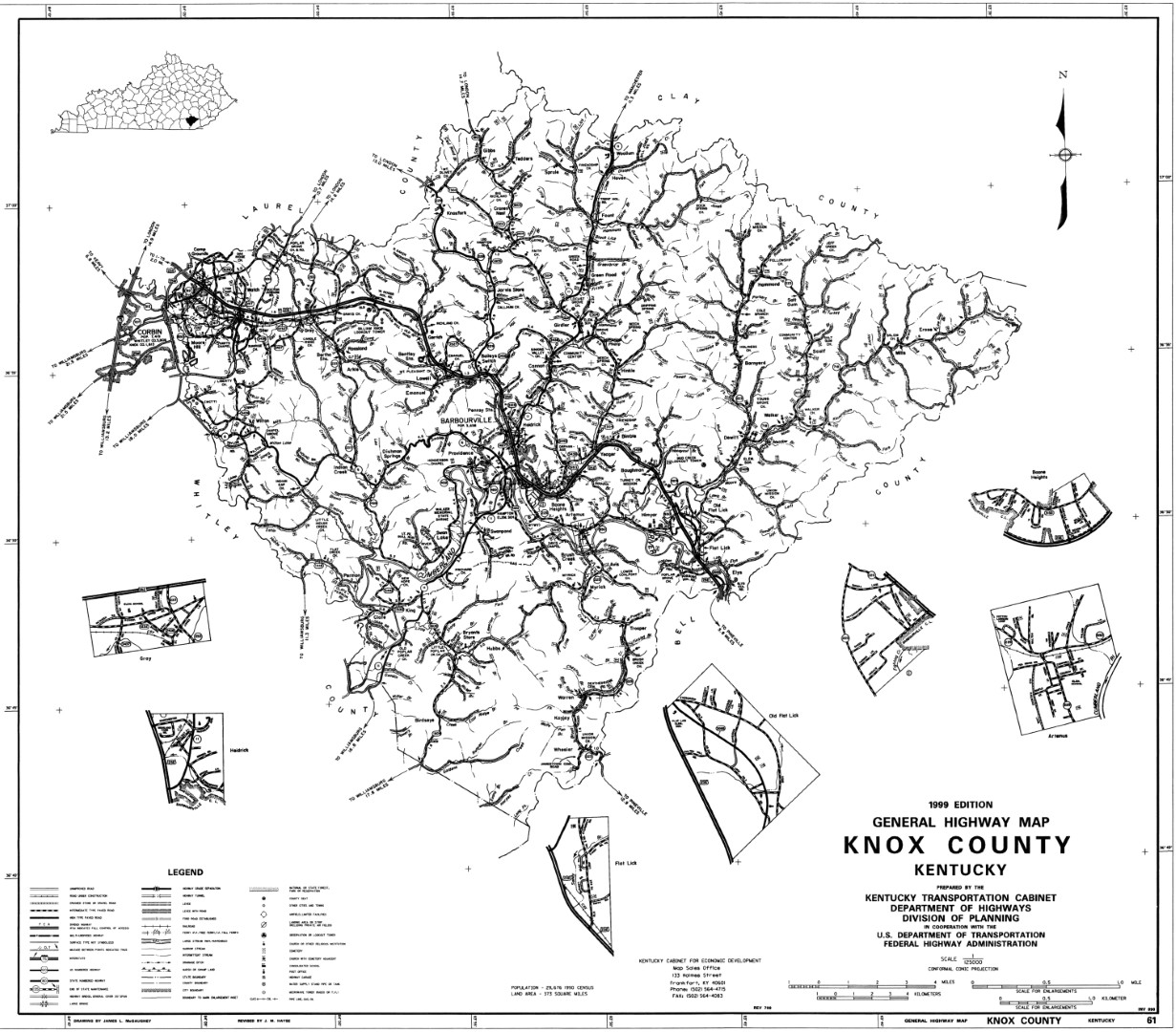
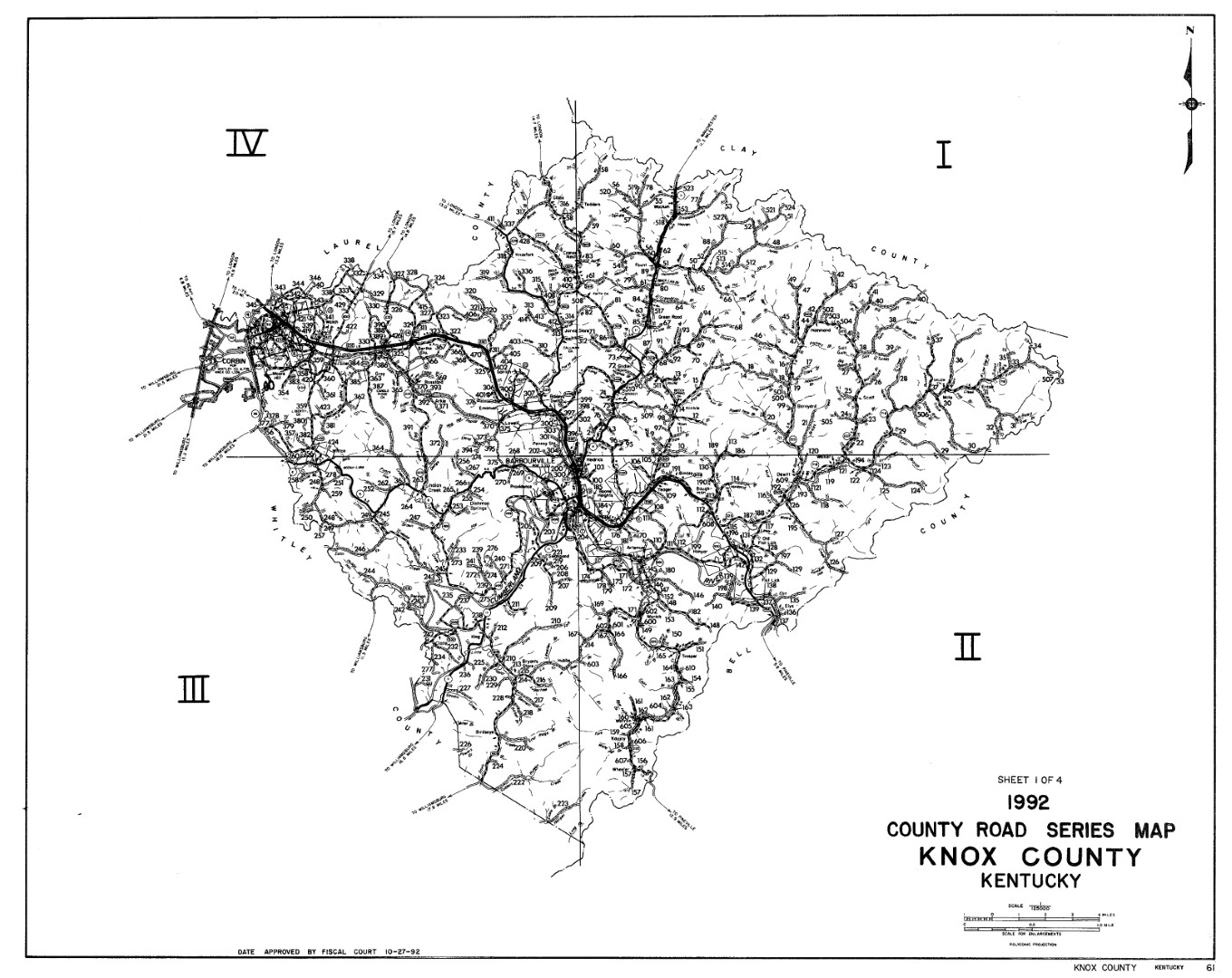
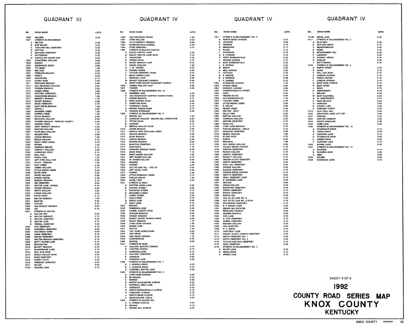
The following maps that came from University of Kentucky 1999 Knox County Map and 1992 Knox County Map. The 1992 map has numbers for road names. The Index can be found here quadrants I and II and quadrants III, and IV.
The Topography map at Topozone is really neat. As Wikipedia explains it, in a broader sense, topography is concerned with local detail in general, including not only relief but also vegetative and human-made features.
Last Update Sunday, 11-Jan-2026 05:07:38 CST
 |
County Coordinator:
Available for Adoption Contact the State Coordinator for more details. Copyright ©2015-2026 KYGenWeb Project. Copyright of submitted items belongs to those responsible for their authorship or creation unless otherwise assigned. |
|