


| Date | |||||||
| FROM: | TO: | Recorded or | |||||
| Name | Spouse | Name | Date | Doc. | Bk & Pg. | Witnesses | Detail |
| A | |||||||
| Adams, John G. | Wilds, George B. | 1 Sep 1877 | Deed | A-463 | 31 Oct 1877; Re-recorded: 30 June 1880 | $25 for the East half of Lot Nos. 54 & 55 in Block 20 on Pidgeon Alley on the plat of Blandville | |
| Adams, John.G., by P.W. Reeves, Commissioner of Ballard Court of Common Pleas | Jenkins, W.W. | 27 May 1872 | Commissioners Deed | A-53 & 54 | 17 Feb 1874; Re-recorded:� 6 Apr 1880 | In the case of I.D. Herald vs. John G. Adams, the house and lot in Blandville, known as the Brick House, was sold at the court house door for $551 with R.M. Shelton, surity; the same deed by John G. Adams to J.N. Bondurant and adjoining the lands of J. Corbett and upon which W.W. Jenkins now resides;� | |
| Adams, Samuel G., of Logan Co., KY | Margaret S. | Gholson, John F. | __ Dec 1857 | Deed | A-391 & 392 | Logan Co., KY: 14 Dec 1857; Re-recorded: 15 June 1880 | $400 for 36 acres, part of the SE Quarter of Section 10 in Township 6, Range 2 West, and on the lines of Adams and James Smith |
| Allbritton, R.T., Sheriff of Graves Co., Ky | Bugg, J.W., of Ballard Co., Ky | 29 Oct 1874 | Sheriff's Sale & Deed | A-131 & 132 | 2 Nov 1874; Re-recorded:�� 29 Apr 1880 | $1,000 for 45 acres owned by S.F. Marshall, adjoining Blandville, being where Marshall now lives, known as the Utterback place, and described in a deed from Dupayster to Marshall. On 5 Sept 1874, the Franklin Circuit Court clerk issued a writ against L.F. Marshall, Sheriff of Ballard Co., for the sum of $10,039.09 with interest, and directed the Graves Co. Sheriff to sell this 45 acres,� among other things, per the law | |
| Anderson, D. Marion | Gardener, T.T. | 8 Mar 1880 | Deed | A-176 & 177 | 11 May 1880 | $ 793 & 12 1/2 cents for 52 7/8 acres, on the waters of Mayfield , being the land deeded to Marion Anderson by Mary Mosby, lying on the lines of the Neidahouse (?) & Perenteney (?) Railroad, Bushens (?) Military Survey, T.T. Gardener,� C.T. Biggs, K.L. Jennings, and Clem Jennings | |
| Armstrong, Elizabeth | James | Couse [or Cruse], R.H. | 10 May 1870 | Deed | A-107 | 22 Apr 1870; Re-recorded: 16 May 1880 | $35 for 1/5th interest in 64 acres, the land upon which P.S Jackson lived at the time of his death |
| Ashbrook, Margaret | Owens, T.J. | 6 July 1867 | Deed | A-525 & 526 | 6 June 1868; Re-recorded:� 28 July 1880 | $572.50 for 57 1/4 acres in the lines of Ewell, said Owens home tract, Neale, and the East bank of Humphreys Creek | |
| Ashbrook,W.G, and wife Fannie,� J.H. Ashbrook and wife Sarah, S.A. Davis, John Davis and Margaret Marrow | Owen, John D. (or T.) | 8 (?) Dec 1876 | Deed | A-559 & 560 | 6 Apr 1877; Re-recorded: 12 Aug 1880 | $1,050 for 70 acres off of the South end of the SW quarter of Section 17, Township 6, Range 2 West, the same upon which W.C. Ashbrook now resides and which was patented to Richd. D. Gholson and conveyed by him to James Ashbrook, Father of the selling parties, and willed to his widow and children, selling parties | |
| Austin, Catherine, of Ballard Co., KY | R.C. | Hayden, J.M., of Hickman Co., KY | 27 Nov 1875 | Deed | A-420 & 421 | 25 June 1876; Re-recorded� 21 June 1880 | $400 for 60 acres, on the West Fork of Mayfield creek, being a part of the SE quarter of Section 4, township 3, R2W, and bounded by G.R. Ryan, Willingham, and R.T. Martin |
| B | |||||||
| Bacon, R.A., of McCracken Co. | E. Ellen, his wife, & daughter of Chiles Terrell, dec'd. | Jenkins, T.J., of Ballard Co. | 15 May 1858 | Deed | A-41, 42 & 43 | McCracken Co: 18 Mar 1858; Ballard: 27 July 1859; Re-recorded:� 3 Apr 1880 | $2,277 for 227 acres on Shawnee Creek, Ballard Co., being the balance of a tract E.E. Bacon had from her father Chiles Terrell, dec'd, in the division among his heirs, on the lines of B.J. Clay, G.J. Jenkins, T.F. Terrell, Julia E. Terrell (now Ennich (?)), & Hawen (?) Penn |
| Bailey, F.D. | R.V. | Newman, A.L. | 6 Oct 1874 | Deed | A-23 | Re-recorded: 19 Apr 1880 | $960 for 60 acres on the waters of Humphreys Creek� |
| Barkley, A.B., of Scott Co., KY | C.V.H., wife | Miller, J.M. & J.G., of Ballard Co., KY | 15 Mar 1854 | Deed | A-375, 376 & 377 | ________; Re-recorded: 12 June 1880 | $1,276.17 for 149 1/2 acres, being the same Berkeley purchased of ;� on the lines of Martha E. Webb, Nancy (?) Webb,� Mary B. Watt; and a 2nd tract of 40 acres on Hazle creek, on the lines of Herring, Clay, Mary B. Watt, and purchased by deed from the Circuit Court after a decision in the case of Hughes vs. Adams |
| Barksdale, Elisha, of Halifax Co., VA | Judith | Holt, Simon, and Robert Summers, of Ballard Co. | 25 May 1870 | Deed to Perfect Conveyance | A-139 & 140 | Halifax Co., VA: 25 May 1870; Ballard Co: 11 Aug 1870; Re-recorded: 30 Apr 1880 | $�� for 1,000 acres: The parties entered into a Deed on 16 Feb 1868 now of record in Ballard Co, which attempted to convey to Holt and Summers the one undivided half of a tract on the waters of Obion, which was patented to William Terry & his wife Polly, John H. Wimbish & Armistead Barksdale on 25 July 1825 in consideration of Land Office Warrant No 36, which 1868 deed did not perfectly describe the land |
| Belcher, Frank S., John R. Belcher (of Tunica Co., MS) & Freeman B. Belcher, children of Margaret & john G. Belcher, deceased, late of Ballard Co. | Crice, James A.� | 11 January 1875 | Deed | A-312 & 313 | Tunica Co., MS: 14 Feb 1870; Re-recorded:� 1 June 1880 | $300 for their undivided half interest in lots in #119, 120, 121 & 122 in Lovelaceville; the remaining half is owned by W.M., Dora G., and Laura B. Belcher, infant children of the sd. Margaret & John G. Belcher. | |
| Belcher, Frank S., of Coahoma Co., Mississippi, by his Attorney in Fact John B Belcher | Crice, James A., of McCracken Co., KY | 13 Oct 1869 | Deed | A-309 & 310 | 19 Oct 1869; Re-recorded: 1 June 1880 | $600 for Lots 121, 122 & 119, all in Lovelaceville | |
| Belcher, John G., heirs, by W.S. Bishop, County Commissioner | Crice, James A. | 16 Sept 1870 | Commissioner's Deed | A-318 & 319 | 17 Dec 1872; Re-reporting:� 2 June 1880 | In consideratin of the premises set forth on a certain suit in chancery in Ballard Circuit Court:� John G. Belcher Heirs Plaintiffs vs James A. Crice Defendant, that the undivided half interest in Lots 119, 120, 121 & 122 in Lovelaceville of the Plaintiffs be sold at the Courthouse door, and Crice purchased for $250 | |
| Belt, Osburn | Louisa C.� | Utterback, George W. | 2 Sept 1865 | Deed | A-268 & 269 | 4 Sept 1865; Re-recorded: 25 May 1880 | $900 for 160 acres, one undivided interest in one half of the North East� Qtr of Section 18, Township 5, Range 3 West (?) |
| Betts, David R., William Dodson and his wife Sarah Dodson, of Vigo Co., IN | Stephens, Isaac, of Ballard Co., KY | 21 Nov 1870 | Deed | A-575, 576 & 577 | Witnesses: W.E. Hendrick & Martin Hollinger; Vigo Co., IN:� 27 Nov 1870; Re-recorded: 17 Aug 1880 | $2,300 for 160 acres, being the NE quarter of Section 28, Township 4, Range 2 West | |
| Billington, Marcinus M., Wm. N., Pennel, and Margaret Ann, Heirs of Jason Billington, by Commissioner, J. Corbett | Gholson, John F. | 8 Apr 1853 | Commissioner's Deed | A-390 & 391 | 25 Nov 1853; Re-recorded: 15 June 1880 | In the case of John F. Gholson vs. Jerome B. Garner, Guardian for the Heirs of Jason Billington, Deceased and others: the deceased conveyed the NW Quarter of Section 15, Township 6, Range 2 West to Gholson, but after his death, the Heirs failed to execute the deed, so the Court appointed Commissioner to do so. | |
| Bishop, B.H. , by Commissioner Jenkins | Aley | Bishop, S.F. | 27 Jan 1878 | Commissioner's Deed | A-561 & 562 | 15 Feb 1878; Re-recording: 16� (?)Aug 1880 | $952.26 for 169 1/2 acres to be laid off the N side of a tract of170 acres of land adjoining the lands and farms of Geo. Hinds, R.D. Fortson, G.N. Strangher, Geo. Hinkle McWaters and R. Bugg sold by the commissioner in the case of C.V. B. Rollins, Plaintff vs. S.S.� Bishop and W.J. Henderson.��� |
| Bishop, J.H. | Alexandra F. | Manor, W.C. | 28 Oct 1874 | Deed | A-370, 371 & 372 | 4 Nov 1874; Re-recorded: 11 June 1880 | $1,000 for 83 acres between the waters of Humphreys creek and Shawnee creek, the land on which Biship now lives,� being the same conveyed to Bishop by J.H. Terrell, who received it in the division of the land of the Terrell heirs, known as lot No. 6; and, on the line of Jacob Bondurant |
| Bishop, John H. | Amanda F. | Marion, Jus. | 22 Dec 1861 | Deed | A-165 | 11 Mar 1863; Re-recorded 6 May 1880 | $2,000 for 115 acres, deeded to Bishop by Reeves & Terrell, plus 40 acres� |
| Bland, Susan L. | Fielding | Utterback, George W. | 6 Dec 1858 | Deed | A-265 & 266 | 24 Dec 1858; Re-recorded: 24 May 1880 | $3,440 for 121 acres, on a SW corner of a 5 acre tract sold by Nathaniel Wickliffe to A.W. Vallandingham (?) on which I.J. Jewett now lives, bounded on a side by Fort jefferson |
| Boswell, George L. | Elizabeth | Holt, Simon | 2 Sept 1879 | Deed | A-147 & 148 | 2 Sep 1879; Re-recorded:� 3 May 1880 | $260 for 250 acres, their entire interest in the home place on which Robert Summers lived at the time of his death, and which was set aside as the dower for Mrs. E. Summers, said tract being 1/9th of the above described land |
| Boyd, G.W. | Emily C. | Leutt, G.J. [of Jautt (?)] | 3 Nov 1854 | Deed | A-421 & 422 | 5 July 1855; Re-recorded: 22 June 1880 | $625 for 5 acres on which said Leuth now resides, adjoining the land of J.S. Ford on the N & S, the land of Thompson on the W, and on the E, the town of Blandville, being the same land purchased by Boyd of A.W. Vallandingham. |
| Boyd, Isaac B. | Julia A. | Holt, Simon | 21 Dec 1863 | Deed | A-141 & 142 | 28 June 1864; Re-recorded:� 14 May 1880� | $4,300 for 250 acres, including (1) 140 acres, on the lines of the miitary survey of Kendrick (?) Woodson,the lines of William Thompson, and between the lines of Wimbish & Sample; and (2), 110 acres from Thompson's survey and bounded by T. Woodson and Thompson |
| Bracken, John A., of Obion Co., TN | M.A. | Cordell, John V., and James Crice | 12 Apr 1876 | Deed | A-322 &323 | Obion Co., TN: 17 July 1876; Re-recorded:� 3 June 1880 | $900 for lots #� in Lovelaceville, known as the Grain Mill property, on Jefferson street in A. Lovelace's line, a creek and on Mayfield Road |
| Branham, Jennie, of Union Co., KY | Cooper, D.J., of McCracken Co., KY | 16 Sep 1876 | Deed | A-296 & 297 | 20 Oct 1876; Re-recorded 28 May 1880 | $50 for 375 acres, called Division #6,� in Ballard Co., on Clanton creek, on which F.B. Martin lived for many years and at his death, and which was divided among the heirs of General William Clark, of record in McCracken Co., KY | |
| Bridgewater, Joseph A. | Mary A. | Terry, John B. | 15 June 1869 | Deed | A-287 & 288 | 3 July 1869; Re-recorded: 24 May 1880 | $810.50 for 80 acres, known as the tract of land owned by John Crice, bounded by Clanton creek and Mally's division lots # 3 & 4, and adjoining land belonging to the heirs of M.J Mostyn, deceased |
| Briney, David | Elizabeth | Fisher, M.H. | 10 Apr 1880 | Reconveyance | A-419 & 420 | 21 June 1880 | $180 for 18 acres, conveyed by Thos. Payne to Birney and from Wm. Taylor to Payne, being part of the SW quarter of Sec 2, Township 4, Range 3 West, on the lines of M. Fisher, Berney, Holden and Spiller |
| Briney, Markis | Sarah Ann | Fisher, Wm. | 31 Aug 1866 | Deed | A-2 & 3 | None, Rerecorded 30 Mar 1880 | $420 for 40 acres on Mayfield Creek, at the NE Quarter of Sec 24, Range 3 (?) West |
| Bristow, Richard J. | S.A. | Holt, James P. | 12 Nov 1877 | Deed | A-223, 224 & 225 | 24 Nov 1877; Re-recorded: 19 May 1880 | A mule that we value at $125 for 1/6th of an acre� in Lovelacevillle, on the NW corner of Lot #24 on Ballard� Street, then to a lot owned by B. Bracken, known as the Armstrong lot, to the corner of the lot of J & J.A. Kimmell, and including within said boundaries the lot belonging to Bristow known as the Dean lot |
| Brown, Thomas, of the City of Columbus, Hickman Co., KY | Annie B. | Collins, Louis, of Ballard Co., KY | __ day of ___ 1876 | Deed | A-586 & 587 | 9 Sep 1876; Re-recorded:� 18 Aug 1876 | $800 for 55 acres, known as the Aicher (?) Survey and lying nearest the City of Columbus |
| Brummell, J.D. | Catherine | Parchment, J.M. | 18 May 1875 | Deed | A-396 & 397 | Recorded 24 July 1875; Re-recorded 16 June 1880 | $ 1,225 for 261 acres, known as the Holloway Survey and deeded by J.W. Holloway to Samuel Edwards, and by J.H. Ashcraft and Jacob Corbell to J.D. Brummal |
| Brummell, John D. | Catherine | Gholson, John F. | 14 June 1878 | Deed | A-394 & 395 | 20 June 1879; Re-recorded:� 16 June 1880 | $663 (?)� for 1/6th interest in __ acres, known as the Holloway land sold by Ashcraft under decree of the US Court held in Paducah, as the land of Samuel Edwards and purchased by Corbett, then conveyed to Brommel, and by Brummel to Parchment, and Parchment to Gholson |
| Bryant, Mary C. of Hickman Co., KY, and James D. Chitwood, of Union Co., New Jersey | Mrs. Jane Chitwood | Holt, G.C. | 18 May 1868 | Deed | A-226, 227 & 228 | Union Co., NJ: 18 May 1868; Hickman Co., KY: 29 June 1868; Ballard Co: 10 Dec 1868; Re-recorded: 19 May 1880 | $400 for all of their undivided interest in ___ acres, known as the NE Quarter of Section 16 (?), Township __, Range 3 (?) West |
| Bugg, Z. W. | Unsell, J.M. | 11 Feb 1862 | Release of Mortgage | A-449 & 450 | 13 Feb 1862; Re-recordedd: 25 June 1880 | $600 dated 24 Dec 1861 payable to Z.W. Bugg, as mortgage on the tract known as Solitude farm, is hereby paid and released | |
| Bugg, Z. W. | Mary A. | Harris, W.S. | 26 Apr 1880 | Deed | A-238 | Replacement Deed: 26 Apr 1880 | Having previously sold property for $200� in Blandville to Harris & Colver on which they built a Blackshop East of Bugg& Bishop Law Offices,� Colver here sells his share to Harris plus a lot North of and the same width as the Shop to Merritt, the lot more fully described in the Deed from Harris & wife to L.J. Rich made 20 Apr 1880 |
| Bugg, Z. W. | Mary A. | Utterback, Mary A., widow of G.W. Utterback, deceased | 4 Mar 1878 | Deed | A-263 & 264 | Re-recorded: 25 May 1880 | $25� for 45 acres adjoining Blandville, and known as the Utterback place, being the same that Sheriff R.T. Allbritton conveyed to Bugg at a sale on October 29, 1874, due to a debt owed by L.L. Marshall (who lived thereon) to Dupoyster |
| Bugg, Z. W. | Mary A. | Utterback,� George W. | 19 Oct 1857 | Deed | A-264 & 265 | 5 Nov 1857; Re-recorded: 25 May 1880 | $65 for all that lot #25 in Blandville which lies West of a line running through the lot parallel to Market Street just missing the chimney of the house of C.S. Marshall, curretly occuied by Thomas Lofton,� |
| Bugg, Z.U., Commissioner | Utterback, G.W. | Sept. 1867 Court Term | Commissioner's Deed | A-272, 273 & 274 | 22 Sept 1873; Re-recorded: 24 May 1880 | In the consolidated cases of H.W. Jones vs. L.C. Braden & others, and James Hughes vs. C.W. Ray, the Commissioner sold Lot #6 in Blandville for $100 to Daniel McNeale, who directed it be conveyed to Utterback | |
| Bugg, Z.W. | Mary A. | Wilds, George B. | 8 Sep 1877 | Deed | A-461 & 462 | 1 Sep 1877; Re-recorded: 30 June 1880 | $250� for 2 acres in Carpenter's addition to the town of Blandville, on the lines of a lot now owned and occupied by sd. E.B. Wild, to Locust street and with said street to the brick church thence E 66 feet, 40 feet, thence West 66 feet, thence West with Locust to Pidgeons Alley thence E with the Alley to Adams lot, then south to the boundary of old town of Blandville |
| Bullock, William F., and Mary Bullock, formerly Mary Pearce, of Jefferson Co., KY; and, William S. Bodley, and Ellen S. Bodley, formerly Ellen Pearce, of Warren Co., MS; Robert C. Stanard and Martha Stanard, formerly Martha Pearce, of Henrico Co., VA | __ ___ 1848 | Deed of Partition | A-246 thru A-251 | 8 May 1849; Re-recorded: 22 May 1880 | Mary, Ellen and Martha being the heirs of Ann Pearce, deceased, (one of the heirs of Jonathan Clark), who died in owning large tracts of land; also with claims, H.W. Vick & Sarah, his wife, former Sarh Pearce, of Edmund and Jonathan Pearce B. Kinkead & eliza his wife, former Eliza Pearce, & H.C. Pindell& Jennie Ann Pearce his wife; [and more info] | ||
| Burps, Ivery Susan | Thomas | Puckett, P. E. | 15 Apr 1880 | Re-Deeded | A-217 & 218 | 15 Apr 1880 | On 15 Nov 1878 the parties conveyed land by deed, destroyed in the subsequent courthouse fire, so the partes hereby reconvey the sd acres for $1, bounded on the E by Doc Sams, on the W by William Morgan, on the N by William Atherton, |
| Burrow, David, Heirs | Myers, John, in right of his wife, Margaret Myers, late Margaret Burrows, one of the children and heirs of David Burrow | 5 Feb 1852 | Agreement to divide land | A-337 & 338 | 5 Feb 1852; Re-recorded 5 June 1880 | The heirs of David Burrow, including John Myers and wife late Margaret Burrow, Canada (?) Atherton & wife late Ellen Burrow, Jacob Hambleton and wife late Lilla (?) Burrow, John Burrow and his wife Eliza, Kimrod (?) Burrow, Mary Burrow and Delila Withrow-late Burrow, agree to cast lots for each heir's portions of the inherited lands; Margaret Myers receiving Lot No 1 consisting of 53 acres | |
| Bysee, J.C. | Matilda "Tildy" Ann | Samples, R.M. | 15 Apr 1880 | Reconveyance | A-284 | 27 May 1880 | On 15 Aug 1877 the parties conveyed 1 1/2 acres by deed subsequently destroyed in the� courthouse fire, so the parties hereby reconvey the sd acres for $1, being part of Section 5, Township 4, Range 2 West, being all of the Byasee tract South of the Milburn and Lovelaceville Road� |
| C | |||||||
| Camp, Wm., by H.L. Anderson, his agent in fact | Webb, W.K. | 2 Sep 1872 | Deed | A-495 | 27 Sep 1872; Re-recorded: 10 July 1880 | $400 for 85 acres, taken off the South side or end of the SE quarter of Section 22, Township 5, Range 2 West, on the waters of Lick creek, the land to be divided by an East-West line | |
| Camp, Wm., of Graves Co., KY, by H.L. Anderson, his agent in fact | Hall, H.S., of Ballard Co. | 20 Sep 1872 | Deed | A-544 & 545 | 27 Sep 1872; Re-recorded: 8 Aug� 1880 | $400 for 75 acres on the waters of Lick creek, taken off the North sde of the SE quarter of Section 22, Township, 5, Range 2 West, to be divided by an East and West line between said Hall and W.H. Webb | |
| Campbell, T.D. | Ursula | Thomas, N.C. (?) | 19 Sep 1859 | Deed | A-509 & 510 | 27 Aug 1861; Re-recorded: 13 July 1880 | $300 for 100 acres, being part of Walter (?) Brooks (?) 1500 (?) acre (?) survey, and on the lines of Edmond Taylor, Martha West (?), and Joseph Thomas� |
| Carrington, Tucker, Attorney, James C. Scott, Mary E. Martin, & Paul C. Venable, of the Mecklenburg Co., VA; and, Wm. W., Henry, & Elizabeth L. Carrington of the County of Halifax, VA | Taylor, Wm. F. | 15 June 1867 | Power of Attorney | A-588 & 589 | Mecklenburg Co., VA: 15 June 1867; Re-recorded: 18 Aug 1880 | POA from the devisees and executors of George Carrington, deceased,� to take control of, etc., and act for them to sell, lease, etc., certain lands in Ballard Co., KY, bequeathed them by said George Carrington, deceased | |
| Carroll, James K., T.L. Carroll, Pleasant N. Carroll and his wife Nancy P., Thomas James & P.E. James his wife, former P.E. Carroll, S.E. Carroll, & A.M. Carroll | Carroll, R.M. | 19 Aug 1879 | Deed | A-302 | 22 Aug 1879; Re-recorded: 31 May 1880 | $9 (?) for partial interest in certain lands (unreadable on my copy) and 4/8ths interest the South half of Section 24, Township 5, Range 3 West, part of the K.R. Taylor farm and conveyed to Joseph Carroll, Sr., by the Master Cases of Ballard Circuit Court on 19 Mar 1870, and bought by R.R. Taylor from Elliott, recorded in Book 4, p. 9. | |
| Chapman, C.C. | Sarah C. | Cate, C.L. | 4 Jan 1870 | Deed | A-98 & 99 | 9 Jan 1871; Re-recorded: 20 Apr 1880 | $350 for Lot #8 in the town of Milburn, part of the SW Quarter section __ township 4 range 2 West |
| Chenault, J.W. | Martha F. | Fisher, M.H. | 25 Oct 1875 | Deed | A-8 & 9 | Re-recorded: 30 Mar 1880 | $216 for 27 acres, bounded by lands of J.W. Watson and Bill Young |
| Clandy, J.D. | Ann F. | Utterback, Mary A., widow, Thomas and Addie Udderback, the only children of G.W. Utterback, deceased | 2 Oct 1876 | Deed | A-282 & 283 | 12 Oct 1876; Re-recorded: 18 Mar 1880 | J.D. Clandy sold to G.W. Utterback a tract of 400 acres in 1843, but Ann Clandy didn't convey her dower share, so this deed conveys that dower share in the land, on which Mary White now lives on her dower share |
| Coffee, W.M. | Elizabeth | Wilds, G.B. | 17 July 1877 | Deed | A-465 & 466 | 16 Aug 1877; Re-recorded: 30 June 1880 | W.M. Coffee sold the property herein after described to Ray & Elliott, and Elizabeth failed to relinquish her dower rights, & whereas W.B. Shelton then owner of the property & sold it to G.B. Wilds who wishes to perfect his title, here Coffee & wife boh convey a house and part of Lot #23 in Block 8 & thereon Shelton's old store house & lot, in Blandville, with 33 feet on the Public Square by 66 feet |
| Coffin, Mrs. M. [Mary] | Utterback, Thomas & Addie, her only children with G.W. Utterback, deceased | 10 Feb 1874 (?) | Deed of Gift | A-130 & 131 | 17 Mar 1877; Re-recorded: 29 Apr 1880 | 214 acres, described in a Deed from _____ to James Fulton and bounded by Susan I. Thompson & J. Crice, being the same land conveyed by James Fulton to N.M. Coffin 28 Sept. 1857 and recorded in Ballard Deed Bk "F", p. 61. G.W. Utterback having in his lifetime become equitably entitled to this land & having sold the same in parts thereof to diverse venders (?) with claims of general warranty; the object of this Deed is to perfect the title in her and her venders | |
| Coil, David | Mary H. | Fisher, James | 28 Mar 1874 | Deed | A-499 & 500 | 28 Apr 1874 (?); Re-recorded: 12 July 1880 | $100 for ___ acres on the waters 0f Mayfield creek, being Lot #_ in the division of land among the heirs of Edmund Riggs, deceased, and allotted to E.R. Davis as one of the children and to Myrick (?) Davis, deceased, and adjoining the land of John Fisher, which land E.R. Davis conveyed to Coil |
| Coleman (?), James G., by Commissioner� | Newman, Andrew | May Term 1848 | Commissioner's Deed | A-234 & 235 | December 1848; Re-recorded: 20 May 1880 | By order of the Logan County Circuit Court in Chancery Session November Term, 1847,� in the case of John Rutherford (?) et al., vs. James M. Glangohn (?), et al., settling the land for the heirs of Thomas Morrow, deceased: $300 for acres, described as the NE Quarter of Section 21, Township 6, Range 2 West | |
| Corbett, J. | Terrell, Frances A., his daughter | 3 Sep 1867 | Deed | A-468 | 19 Aug 1874; Re-recorded: 1 July 1880 | $490 for (1) 180 acres on the waters of Mayfield Creek, being the NE Quarter of Section 31, Township 5, Range 2 West; and (2) 20 acres of the NW quarter of Section 32, Township 5, Range 2 West, purchased by virtue of a decree | |
| Corbett, J. | Terrell, Frances A., his daughter | 17 Aug 1874 | Deed of Gift | A-469 | 17 Aug 1874; Re-recorded:� 1 July 1880 | 320 acres, known as the J.D. Terrell farm, purchased at Commissioners sale and the 1 acre Lot upon which Fannie Terrell and family now reside, lying between the Lot I sold to John Ray and the one on which Corett now lives | |
| Corbett, J.,� B.A. Lane and his wife Harriet L. Lane and Wm. D. Lane and his wife, Sarah H. Lane | Pettit, Thomas H. | 21 Dec 1871 | Deed | A-484 & 485 | 13 Jan 1873; Re-recorded: 3 June 1880 | $150 for 15 acres, the same land conveyed to J.T. Ross by B.J. Crouch and from J.T. Ross to B.A. and R.I. Land & J. Corbtt, which Deed from Crouch to Ross is referenced for boundaries | |
| Corbett, J., as Commissioner | Barkeley, A.B. | 20 Sep 1860 | Commissioner's Deed | A-377 & 378 | 4 Oct 1857; Re-recorded: 12 June 1880 | By order of the Ballard Circiut Court this October term 1857, for $26.98, 40 acres on the lines of U.M. Thomas in the Mary B. Watt Survey, Herring, Clay | |
| Corbett, Jacob | Brownnall, J.D., of McCracken Co., KY | 2 Mar 1876 | Deed | A-393 & 394 | 2 Mar 1876; Re-recorded:� 16 June 1880 | $2,000 for acres, being several tracts of land, and house and Lot, being the same conveyed by J.H. Ashcraft, Deputy for E.H. Murrey, US Marshall for the district of KY dated 25 Aug 1875; 120 acres on SE Qtr of Sec 19, Twshp 7, Range 2 West, conveyed to S. Edwards by J.C. Brooks; 2 tracts on the waters of Humphreys Creek, 261 acres deeded by S. Edwards to J.M. Holloway on 8 Sep 1854, and 145 acres deeded by Samuel Tribble to S. Edwards on 25 Oct 1860; and, a house and lot in the town of Woodville, conveyed by W. (?) C. Vaughan to Edwards | |
| Cothes, H., of Collin Co., Texas | G.A., his wife | McMullen, John, of Ballard Co., KY | 9 Oct 1876 | Deed | A-523 & 524 | Collin Co., TX: 9 Oct 1876; Re-recorded: 27 July 1880 | $440 for 50 acres on the lines of the Read tract, in the old military line, and the bank of the West fork Creek with its meanders |
| Cothes, H.V. | Harriett A. Cothes | Utterback, G.W. | 20 Aug 1874 | Deed | A-280 & 281 | 21 Aug 1874; Re-recorded: 26 May 1880 | $162 for 80 acres, a part of Section 10, Township 7, Range 3 West |
| Cothes, Herman, of Texas | G.A. Cothes | Neuman, Mike, of Ballard Co. | 16 Oct 1876 | Deed | A-206 & 207 | 28 Oct 1876 Collin Co., TX; Re-recorded:� 15 May 1880 | $1,200 for 100 acres, on the banks of Westfork of Mayfield Creek [description on my copy too dark to read] |
| Cotton, P.G. | K.L., wife | Winfrey, S. N. | 3 Sep 1878 | Deed | A-574 & 575 | 3 Sep 1878; Re-recorded: 16 Aug 1880 | $200 for part of Lot No. 8 (?) in Arlington, bounded by W.A. Maywood and W.J. Sullivan, on Walnut Street, 20 feet across and back 100 feet |
| Crockett, John W. | America | Juett, Thomas� J. | 3 July 1847 | Deed | A-466 & 467 | 24 Nov 1847; Re-recorded: 30 June 1880 | $400 for Lot No. 29 in Blandville, and a strip of land lying on the north side of said Lot |
| Cromwell, Joseph G., of Marshall Co., KY | Newman, Elizabeth Ann,� of Ballard Co. | 22 Apr 1856 | Deed | A-228 & 229 | 30 July 1856; Re-recorded: 19 May 1880 | $495 for 123 3/4 acres on the waters of Humphreys creek, a part of NE Quarter Section 17, Township 6, Range 2 West | |
| Crouch, Martha, Elizabeth Crouch, & J.G. Crouch, infant children of John Crouch, deceased, by Commissioner Bishop | Ross, N.A. | __ day of __ 1869 | Commissioner's Deed | A-563, 564 & 565 | 12 Oct 1869; Re-recorded: 14 Aug 1880 | $2,001 for 8/9ths of the SW quarter of Section 21, Township 6, Range 2 West, and a portion of the same land conveyed by J. Kemmet to John Crouch on 1 Jan 1856 | |
| Cummins, Michael | Nancy | Cummins, Ann Dromaky, Josiah Asberry, and Mason Elizabeth | 2 Apr 1851 | Deed | A-403 & 404 | 9 Aug 1851; Re-recorded: 17 June 1880 | $300 for 105 acres on the waters of West Mayfield creek and on the line of the NE corner of Section 17, Township 4, Range� 2 __ |
| Curd, Charles, of Calloway Co., KY | Ross, N.A., of Ballard Co., KY | 27 Nov 1875 | Deed | A-568 & 569 | 29 Jan 1876; Re-recorded: 16 Aug 1876 | $439.60 for 142 acres, NW Quarter of Section 28, Township 6, Range 2 West | |
| D | |||||||
| Daniel, John P. | Howle, Caleb | 8 Oct 1852 | Deed | A-109 | 19 Nov 1852; Re-recorded: 22 Apr 1880 | $180 for 160 acres on the waters of the West Fork of Mayfield Creek, in the SW quarter of Section 14, Township 5, Range 3 West (complete, except 40 acres laid off the NW corner by the Levrington (?) survey of the quarter section) | |
| Davis, Edward T. | Fisher, James | 9 Mar 1872 (?) | Deed | A-498 | __ June 1872; Re-recorded: 12 June 1880 | $100 for 10 acres on Mayfield creek, being Lot #6 in the division of land among the heirs of Edmund Riggs as shown in Deed Book J. P. 246-264 | |
| Davis, John S. | Shelton, R.M., W.J. Harkless & S.B. Dod [or Dodd (?)] | 14 June 1876 | Deed | A-174 & 175 | 19 June 1876; Re-recorded: 10 May 1880 | $120 for 31 acres; Shelton, et al., holds a note against Davis for the balance being paid of last payment due of the purchase price of the land herein conveyed; the same land purchased by Davis of E.R. Davis, upon which a lein exists; described as the land and dwelling house on which Myrick Davis lived at the time of his death, being a part of the old John Davis farm, adjoining the lands of G.W. Martin, J. Corbett & others on the West Fork of Mayfield creek� | |
| Davis, John, and Jesse Mishew [or Meshew] | Sarah A. Davis & Allice Meshew | Russell, Wm. G. | 27 Dec 1875 | Deed | A-526 & 527 | 24 Apr 1876; Re-recorded:� 28 July 1880 | $500 for 45 acres on the waters of Mayfield creek and known as the old Lewis Mishew farm, adjoining the farm of J.B. Ross, W.A. Ross, Ben Kimmell, & John Rudolph� |
| Denney, James H. [or Denny] | Mahalany (?) | Terrell, F.A. | 5 July 1879 | Deed | A-472 & 473 | 17 July 1879; Re-recorded: 1 July 1880 | Whereas, Denney signed a Note for $940 on 7 Sep 1877 for 80 acres in the NE corner of Sec 31, Township 5, Range 2 West and on the lines of Samples and Rudd on the waters of West Fork of Mayfield creek, part of the land conveyed to Fannie Terrell by J. Corbett, and Denney was unable to pay any part thereof, he hereby deeds the land back to Terrell |
| Dennison, A.N. | Armstrong, Rhoda | 22 Oct 1868 | Deed | A-295 & 296 | 8 Dec 1868; Re-recorded: 28 May 1880 | $300 for the Southern part of Lot #3 in Blandville,� | |
| Dilworth [or Dileworth], F.G. | Mary E. | Moore, A.J. | 3 May 1880 | Reconveyance | A-496 & 497 | 12 July 1880 | On 1 Aug 1879, Dilworth conveyed the land and the deed for 10 (?) acres, being a portion of Section 19, Township 7 Range 2 West, in the lines of David Moore and Shelby, which deed was destroyed by the Courthouse fire |
| Dodson, J.C. "Crice" | Martha | Hickerson, Joseph W. | 24 Mar 1865 | Deed | A-291 | 31 July 1865; Re-recorded:� 26 May 1880 | $200 for all of Martha Dodson's interest in 22 1/4 acres, Lot #2 tract divided by the Commissioner |
| Duncan, S.C. and J.W. Waltrip and wife, C.B. Waltrip | Ray, W.C. | 26 Feb 1880 | Deed | A-354 & 355 | 8 June 1880 | $100 for 100 acres allotted to Mrs. C.J. Duncan as devisee of Robert M. Duncan, and in the NW corner of the whole R.M. Duncan tract | |
| Dupoyster, Joseph C. | Rebecca L.� | Utterback, G.W. | 8 Sept 1870 | Deed | A-275 | 18 Apr 1871; Re-reorded: 24 May 1880 | $700 for Lot # __ in landville, frontng on ___ Street, being the property on which Dupoyster now resides and which he purchased from L.R. Rich |
| Dupoyster, Joseph C. | Rebecca L.� | Utterback, G.W. | 28 Feb 1871 | Deed | A-276 & 277 | __ Apr 1871; Re-recorded: 26 May 1880 | $1.785 for 51 acres on the lines of O. Belt, the Mound City Road, the Turnpike road from Blandville to Cairo, being part of the land conveyed by Utterback to Dupoyster on 8 Sep 1870 |
| E | |||||||
| Ellegood, J. G. & F.A., his wife, G.W. Ellegood, E.A. Marton and John Marton, of Hickman Co., M.J. King and M.W. King, her husband, N.E. Reynolds and W.G. Reynolds, her husband, S.E. Hayden and G.T. Hayden, her husband, P.C. Princer and S. Princer, her husband, heirs of G. Ellegood [or Ellgood] | Haydon, M.S., of Ballard Co. | 4 Oct 1879 | Deed of Gift | A-481, 482, & 483 | 16 Jan 1880; Re-recorded: 2 July 1880 | $5 for 12 acres on the waters of Obion, being a part of the SW quarter of Section 25, Township 4, Range 2 West | |
| Elliott, Qaceriah (?) | Eliza | Weston, William G. , of Steward Co., TN | 11 Jan 1868 | Deed | A-214 & 215 | 1 Feb 1858; Re-recorded: 17 May 1880 | $203 for 210 acres, on the lines of Mrs. Davis and the Military Survey; and 17 acres on the East side of the above, described as between Elliott and Adam Coil and now in a suit between Elliott and Coil |
| Elliott, William M., of Cairo, IL | Hall, Hiram, of Cairo, IL | 2 Dec 1878 | Deed | A-431, 432 & 433 | W.H. Morris and Henry Elliott; Cairo, IL:� 2 Dec 1878; Re-recorded: 24 June 1880 | $450 for 121 acres, on the waters of the Ohio Riveer between Mound City and Cairo, IL, being Lot # 2 in the division of the lands of John Stone, deceased, late of Ballard Co., and conveyed to Barbara Hall, late Stone, one of the heirs; said Hall and her husband, Anthony Hall, to Allen Hawes on 25 Mar 1878, and from Hawes and Margaret his wife to William M. Elliott by deed 28 Nov 1878 | |
| Ellis, George L. | Virginia | Singetary, Don, Dr. | 12 Nov 1878 | Deed | A-582 & 583 | 25 July 1878; Re-recorded: 18 Aug 1880 | $50 for 100 feet off of the North side of Lot #60 in Arlington, beginning E of Lot 60 and running West across the entire Lot, between ____ Alley and the lot of George Magruder |
| Elliston, W.B. | Lyda Elliston | Cate, Annie W. | 18 Dec 1877 | Deed | A-97 & 98 | 18 Dec 1877; Re-recorded: 20 Apr 1880 | $400 for acres, a lot in the town of Milburn fronting Columbus street and known as the lot now occupied by� W.B. Elliston, bounded by J.N. Sanford's store, A. Noriss, T.B. Green, & D.E. O Reid |
| Epperson, J. F. by Ballard Co. Court of Common Pleas Commissioner, J.D. White | Lawrence, J. S. | 19 Feb 1880 | Commissioner's Deed | A-91 & 92 | 5 Mar 1880; 19 Apr 1880 | $503.50, for the undivided interest of 1/5th each in 200 acres, the tract deeded by W.P. Howle & wife to S.H. Epperson | |
| Ewell, John, of McCracken Co., KY | A.C. Ewell | Newman, Andrew of Ballard Co. | 9 July 1850 | Deed | A-255, 256 & 257 | 17 Aug 1850; Re-recorded: 24 May 1880 | $465.62 for 234 acres, the larger portion of which is in Ballard Co., and known and designated as being part of Charles Ewell's Military Survey, on the ridge between the headwaters of the Massack & Humphreys creek, bounded by the 2 acres previously given for the use and benefit of the Massac Methodist church, Hall's line, the survey line |
| F | |||||||
| Ferguson, J.D. | Z.A., his wife | Gupton, William M., guardian for his children, William, Susan and Anna | 28 Feb 1876 | Deed | A-415 & 416 | 25 Feb 1876; Re-recorded:� 19 June 1880 | In consideration of a farm owned by Gupton and his wife, valued at $1,000, for a tract of 117 acres, in the event of said Gupton's death, his wife gets dower, being part of the tract sold by Gupton of Caleb Terrell, deceased. 200 acres of which were sold to B. Price; bounded by John Tisdale and adjoining the land of said Price |
| Fisher, M.H., and M.W. his wife; and, G.J. King and D.F. , his wife | Singletary, Don, M.D. | 12 Feb 1877 | Deed | A-580 & 581 | 13 Apr 1877; Re-recorded:� 14 Aug 1880 | $375 for a town lot, beginning at the SW corner of Lot #66 in Arlington and on the lines of Mound Street, Samuel Morris, M.C. Christopher (?) and Bayle (?) | |
| Fisher, Wm. B. | Sarah L. | Fisher, I.N.H. | 1 Apr 1867 | Deed | A-5 & 6 | Re-recorded 20 Mar 1880 | $2,000 for 2 tracts: (1) 40 acres Fisher purchased of Marks & Sarah� Briney recorded in Deed Bk H, p. 361; (2) 115 acres purchased of W.C. Shaffer recorded in Deed Bk G, p. 362, to which title is doubtful |
| Flack, John R. | Mary F. | James, Martha F. (wife of G.L. James)� | 2 May 1876 | Deed | A-65 & 66 | 8 Sept 1876; Re-recorded: 8 Apr 1880 | $800 for 42 1/4 acres on the waters of Shawnee Creek, know as Lot #1 in the division of land among Dabney Sneed's heirs,� |
| Flournoy, L.M., of McCracken Co., KY | Safford, A.B., of Alexander Co., IL | 5 June 1868 | Deed | A-239 & 240 | G.F. Robb; 24 Sep 1868; Re-recorded: 21 May 1880 | $5,000 for 1/3 of 700 acres in Ballard Co., lying on the Mississippi River in the Logan & Myers Treasury Warrant Survey, being Flournoy's interest in said tract conveyed to him & J.B. Rowland (?) and G.F. Norton by M.B. Hawthorne on 8 June 1852; And,� River Lots 6, 3 & 4, part of Logan & Myers Survey, containing 820 acres | |
| Flournoy, Lafayette M., of Paducah, McCracken Co., KY | Safford, A.B., of Cairo, Alexander Co., IL | 23 Mar 1870 | Deed & Copy of Order and Case File | A-240 thru 245 | 28 Mar 1870; Re-recorded:� 19 May 1880 | By a McCracken Co. decree on 8 Nov 1858 in John Wilson Admin., vs. John Wilson heirs and creditors, $2,000 for land of John Wilson, dec'd,� incl. Jefferson town lots on Mayfied Creek & 154 1/2 acres in tracts on the Mississippi River,� in Todd Military Survey & Logan Military Warrant Survey; Flournoy's 1/4 interest under a Deed dated 1859 by Mary Wilson, John B. & Mary Hivaland (?), & John B. & Rebecca Hunter, heirs of John Wilson, deceased, to Norton, Flournoy, Calhoun and Grinle; the County clerk having failed to make a deed, it was made in 1870 substituting Swafford for Flournoy, etc... | |
| Flournoy, Mary A., Kate Flournoy, K.R. Flournoy� E. A. Boswell and Lucy C. Barnett | Hendricks, Henry | __ Dec 1879 | Deed | A-486 & 487 | 26 Jan 1880; 5 July 1880 | $1200 for 226 acres on the meanders of the Ohio River at the upper corner of the Henry Innis survey,� and on the lines of the survey, Sandy Slough, and T. W. Flournoy | |
| Flournoy, Thomas H., and John F. Harriss, both of Paducah, Ky | Mary A. Flournoy & Mary D. Harriss | Dale, Fielding A., of Ballard Co. | 14 Sep 1863 | Deed | A-134 & 135 | McCracken Co: 14 Sep 1863; Ballard: 2 Apr 1864; Re-recorded: 29 Apr 1880 | $ 3,000 for 250 acres on the waters of Shawnee Creek, on the line of Thos. Henderson's 250 acres, 6/10th of which is sold by Flournoy and 4/10th by Harriss |
| Foree, P.O., and wife M.A., C.A. Elliott & wife N.J., Mrs. M.H. Marshall, J.M. Nichols and wife ___, Heirs of Joshua Foree, deceased, of Ballard Co., KY | Scott, L.C. | 29 Jan 1880 | Re-conveyance | A-373, 374 & 375 | 17 Apr 1880; 11 June 1880 | 100 acres on or near the waters of Humphreys creek and the line of Turk | |
| Fulton, James | Elizabeth | Utterback, George W. | 21 May 1860 | Deed | A-247 & 248 | 14 July 1860; Re-recorded: 20 May 1880 | $380 for 31 3/4 acres & 24 poles, know as part of the land conveyed to Fulton by Nathaniel Wickliffe on the waters of Stovalls creek, on the lines of W.S. Watson, Utterback & Fulton. |
| Fulton, James, Administrator, et al.,� by J.D. White, Special Commissioner | Utterback, G.W. | __ Oct 1872 | Commissioner's Deed | A-278, 279 & 280 | 25 Nov 1870; Re-recorded:� 26 May 1880 | In Ballard County Circuit Court case of James Fulton, Administrator, vs. James Fulton heirs & creditors on the one part, vs. George W. Utterback; in consideration of $__ for the Fulton land, occupied by james Fulton at the timeof his death, containing 180 acres | |
| G | |||||||
| Gajani, Mary A. | Malt, Thomas C. | 2 Oct 1868 | Deed | A-225 & 226 | 16 Nov 1868; Re-recorded:� 18 May 1880� | 200 for one undivided fourth part of� 160 acres, known as the NE Quarter Section 12, Township 4, Range 2 West, being the same land owned by Baker Woodruff, deceased | |
| Garland, E.B., late Hudgins, of Graves Co., KY | Griffith, E.A., of Ballard Co., KY | 15 May 1880 | Replacement Deed | A-411 & 412 | 18 June 1880 | $100 for 26 acres, it being the W.H. Hudgins farm, it being __ by his daughter E.B. Garland on his death, and on the waters of Mayfield creek, bounded on the E by 24 acres belonging to E.A. Griffith, on the West by A.B. Atherton, on the South by J.G. Taylor and the North by Wess Bugg and A.P. Griffith | |
| Garner, Thomas | Susan | Taylor, John G. | 21 Aug 1871 | Deed | A-400 & 401 | 24 Aug 1871; Re-recorded:� 17 June 1880 | $200 for 38 (?) acres in Ballard Co., including all the improvements and the crop |
| Garrett, Isaac, of Christian Co., KY [or Garnett] | Jane G. | Bondurant, Jacob N., of Ballard Co. | 15 May 1860 | Deed | A-123 & 124 | 16 Nov 1860; Re-recorded: 24 Apr 1880�� | $18,400 for 700 acres on the waters of Humphreys creek, it being part f the survey purchased by Garrett from Isaac Clark |
| George, Rubin | Indiana | Cate, C.L. | 4 Jan 1867 | Deed | A-95 & 96 | 27 Aug 1867; Re-recorded:� 20 Apr 1880 | $1,200 for 60 acres, being the S side of the NE Quarter of Section 30 Township 4� Range 2 West |
| Gholson, J.F. and J. E., in the action of the Will of James J. Gholson | O'Douley, J.L., of Christian Co., KY | 15 Oct 1870 | Deed | A-350 & 351 | 24 Oct 1870; Re-recorded:� 8 June 1880 | $2,416.50 for 1,945 (?) acres and 14 poles, owned by James J. Gholson, deceased, and known as part of the NE and NW quarters of Section 16, Township 6, Range 2 West, in the lines of J.H. Buchanan, Thos. (?)Neuman, the Blandville Telegraph Road, Perry Newman, and J.E. Gholson | |
| Gholson, John F. | Newman, Perry | 26 Apr 1868 | Deed | A-127 | 27 Apr 1868; Re-recorded: 12 Apr 1880� | $470 for 28 acres in a part of the NW quarter of the Sec. 15 Township 6 Range 2 West, bounded by John F. Gholson and Andy Newman | |
| Gholson, John F., and J.E. Gholson, Executors of the Will of James J. Gholson, Deceased | Newman, Perry | 26 Apr 1868 | Deed | A-129 | 9 Dec. 1868; Re-recorded:�� 29 Apr 1880�� | $772 for 51 acres & 52 poles, a part of the SE Quarter of Section 16 Township 6, Range 2 West, bounded by the Blandville Road and John Gholson's line | |
| Gholson, R.D. | Jane M. | Manion, Jno. | 19 Oct 1857 | Deed | A-163 & 164 | 21 Dc 1857; Re-recorded: 6 May 1880 | $4,000 for 297 acres, the tract upon which Gholson now lives, on the SW corner of Section 6, tsp 6 Range 2 W, on Brushy fork of Humphreys creek, with J.W. Owens line; Within these lands includes all the land I bought of S.H. Perryin (?) and� J.H. Owens being adjoining portions |
| Glenn, G.L. | L. F. , his wife | R.F. Robertson | 3 Apr 1880 | Reconveyance | A-353 & 354 | 8 June 1880 | $800 for 2 lots in Blandville # 2 & 3, and also a tract adjoining the back hereof, being the same tract deeded by Z.W. Bugg and wife Mary to James McCauley, now deceased, by deed 27 Oct 1866, containing about 3/4 of an acre, and first conveyed to G.L. Glenn 1 Jan 1877 by Sarah V. Lewis, formerly McCauley, and her husband James F. Lewis, reconveyed here after the Courthouse fire |
| Charles B. Grannis and Company, doing business in the City of New York and incorporated by Charmes B, John M. and Henry E. Grannis acting , by and through Charles B. Grannis | Newman, Andrew, of Ballard Co., KY | 5 Oct 1867 | Deed | A-231, 232 & 233 | In the presence of Julius R. Pomeroy & Thomas Newman; 5 Nov 1867; Re-recorded: 20 May 1880; Ratified by: Thomas S. Harlow, 12 Dec 1867 | $1,000 for 150 acres, the SE quarter of Section 9, Township 6, Range 2, West, being the same deeded to the firm or to Thomas H. Waslow (?) by Adam McPherson 12 January 1841 in McCracken Co., KY | |
| Gratheny, Richard C., and Elizabeth C. & Mary E. Gratheny, by their Attorney in Fact, Richard C. Gratheny, of Louisville, KY | Rudolph, Wiley, of McCracken Co., KY | 8 April 1863 | Deed | A-506, 507 &508 | 8 April 1863; Re-recorded: 13 June 1880 | $1,100 [cannot read on my copy] | |
| Gray, Mary Elizabeth | James S. | Smith, Robert | 29 Nov 1879 | Deed | A-69 & 70 | 18 Dec 1879; Re-recorded:� 8 Apr 1880 | $750 for 60 acres off the E. Gray tract of land, on the lines of the Columbus road and Denton |
| Gray, N.B. | Virginia | Mosby, Mrs. Mary E. | 2 Oct 1875 | Deed | A-503 & 504 | Hickman Co., KY: 29 Mar 1876; 22 Jan 1878; Re-recorded: 12 June 18808 | $750 and Lot #136 in the own of Columbus, KY, for 147 acres, near the Blandville and Columbus road, about 6 miles outside of Columbus, known as the Fair Oaks Plantation and 40 acres, known as the Hatton & Wimbish place,� on the lines of Corey and McLane |
| Green, William | Mary J., late Wray, one of the children & heirs of Nancy W. Wray, dec'd | Wray, John M. | 3 Sep 1872 | Deed | A-539 & 540 | 27 Sep 1872; Re-recorded: 30 July 1880 | $300 for one undivided interest in� 185 acres on the waters of Humphreys creek, the land upon which said John M. Wray now resides, and being a part of the SW quarter and fractional SE quarter of Section __, Township 7, range 2 & 3 West, and being a part of the land conveyed by H. Millikin & wife to W.T. Neal, trustee for said Nancy M. Wray Dec'd and her bodily heirs |
| Griffin, W.P. | Sallee, W. E. | 9 Apr 1865 | Deed | A-505 & 506 | Unreadable date; Re-recorded: 13 July 1880 | $1,480 for 124 acres, being a part of the SE quarter of Section 10, Township 6, range 2 West, it being the East portion of said quarter and all of said quarter except 26 acres deeded to J.P. Gholson (?) | |
| Griffin, W.P., of McCracken Co., KY | Trice,� James A., of Ballard Co. | 23 Sep 1871 | Deed | A-320 & 321 | 28 Oct 1871; Re-recorded: 2 June 1880 | $260 for 50 acres on the waters of Mayfield creek and being the NE corner of NE Quarter Section 35, Township 6, Range 2 West | |
| Griffith,� S.W. | Sarah A.� | Trice, James A. & H.H. | 2 Jan 1878 | Deed | A-325 & 326 | 28 Jan 1878; Re-recorded: 3 June 18880 | $315 ($50 to pay off a mortgage in favor of Dr. Shelton of Blandville) for 53 acres on the lines between James Atherton and Robert Parton, and on the line of F.M. Atherton |
| H | |||||||
| Hall, Barbary, late Stone | Anthon | Hawes, Allen | 20 Mar 1878 | Deed | A-409, 410 & 411 | Cairo, IL:� 2 Dec 1878; Re-recorded: 18 June 1880 | $1,000 for 121 acres, conveyed as Lot #2 to Hall by Commissioner's Deed made to partition the land of John Stone, Deceased |
| Hall, M.K. | A.L., her husband | Hall, T.J. | 3 June 1876 | Deed | A-521 | 10 June 1876; Re-recorded:� 28 July 1880 | $160 for 21 1/4 acres, Lot #1 in the Division of Arlenia Klapp land, but miscalled Martha Klapp in Commissioner's Deed, and located on the lines of the SW corner of Lot #2 |
| Hall, Wm. I. | Martha A.E. Hall | Hall, Thomas J. | 13 Nov 1850 | Deed | A-519 | 31 Dec 1856; Re-recorded:� 27 July 1880 | $170 for 80 acres, half of the SW Quarter of Section 22, Township 5, Range 2 West, and Lick creek to be the Eastern line in the division of said Quarter section |
| Hammonds, J.M. | C.E., wife | Griffith, E. A. | 8 Feb 1879 | Deed | A-412 & 413 | 27 Mar 1879; Re-recorded: 18 June 1880 | $100 for 24 acres of the Hudgins farm held by his daughter M.H. Slaughter as one of the heirs of Hudgins, and on the waters of Mayfield creek, bounded on the East by 24 acres owned by Sam Hook, West by 24 acres owned by E.B. Garland, North by Z.W. Bugg and South by G. Kimmell |
| Hampton, W.B. | Clara F. | Carter, Jas. D. | 17 Jan 1878 | Deed | A-93 & 94 | Attest: M. Cummins; 17 Apr 1880 | $235 for 23 1/2� acres, part of the NE quarter section 23 township 5 range three West, in the line of McClure |
| Haney, John | Elizabeth | Utterback. G.W. | 30 May 1867 | Deed | A-271 & 272 | 30 May 1867; Re-recorded:� 28 May 1880 | $310 for the dower interest of Elizabeth Haney, that belongs to her as widow as James Fulton, deceased, known as the Fulton place, lying on Stovalls creek, including any rents due thereon and crops� |
| Harkless, John D. [or O.] | Sarah A. | Wilds, George B. | 2 Aug 1877 | Deed | A-464 & 465 | 10 Sep 1877; Re-recording: 30 June 1880 | $250 for 1 acre containing a house and lot in Blandville, known as all of Lot #29, less 5 feet on the West end thereof, of Block 11 on the town plat, on the lines of Market Street and the Lot #30 of G.W. Hite |
| Harper Benjamin C. | Myers, John | 30 Sep 1848 | Deed | A-336 | 4 Nov 1848; Re-recorded: 5 May 1880 | $72 for 36 acres on the waters of Mayfield creek, on the NE corner of the SW Quarter of Section 24, Township 5, Range 2 West | |
| Harper, W.B. | Mattie E.� | Bonds, M.E. | 8 Mar 1880 | Deed | A-116 | 22 Mar 1880 | $700 for 110 acres, on the lines of S.K. Wakefield's SW corner, Cypress Slough, the Big Branch, Gitsworth's� (?) line, and Ancanisa� (?) Ragland's , it being the land bought off Sanford Parker by W.B. Harper |
| Harris, J.S., by Z.W. Bugg, Commissioner | Thomas H. Corbett purchased the property and agree to pay/convey to W.P. Halliday, with J. Corbett as surity | 22 Aug 1873 | Commissioner's Deed | A-37 & 38 | Ballard Co: 20 Nov 1872; Re-recorded:� 2 Apr 1880 | Judgement of Court of Common Pleas May Term 1872, Louis S. Lee, Admin of James S. Harris, dec'd vs. his Heirs & Auditors; to sell the land at public auction: Sold for $847.22 (amt. of claim) for the least amount of acreage = 90 acres (the amt of land remaining after widows dower) | |
| Harris, Lafayette | Alexandria (?) | Wilds, G.B & J.D. | 29 Oct 1870 | Deed | A-458 & 459 | 28 Dec 1870; Re-recorded: 29 June 1880 | $219.65 for 8 6/8ths (?) acres on the waters of Mayfield creek, a portion of and taken from the SW of the land purchased by Harris frm G.W. Utterback, and lying E of the Blandville & Caledonia road |
| Hauser, Josephus, and G.D. Alcock, of Ballard Co. | Hulda Alcock | Halliday, W.P., of Cairo, Ill. | 13 Mar 1877 | Deed | A-29, 30 & 31 | Re-recorded 1 Apr 1880, from the estate of Josephus Hauser | $10,000 (mostly by promisary notes) for 145 acres on the waters of the Ohio River, including Lot #3 given to Hulda Alcock in the division of lands of James Haws, deceased between his children & widow, Lots 4 & 5 to the widow nnow deceased, part of #4 as a dower & part as a heir of� J.H. Haws & not including those parts sold 17 Dec 1874 by J.D. Alcock & wife Hulda to Josephus Hauser to pay James Haws debts, which deed is here reconfirmed. |
| Hawes, Allen | Mary A. | Elliott, William M., of Cairo, Illinois | 28 Nov 1878 | Deed | A-428, 229 & 230 | Witnesses: John Z. Harmon [or� and Henry Elliott; Cairo, IL: 28 Nov 1878; Re-recorded:� 23 June 1880 | $450 for 121 acres on the waters of the Ohio River and between Mound City and Cairo, IL., being lot #2 in the division of the property of John Stone, deceased, late of Ballard Co., conveyed to Barbara Hall, late Barbara Stone, one of the his heirs, by Commissioner Bugg; and conveyed by Barbara and Anthony Hall (her husband) to Allen Hawes on 21 Mar 1878 |
| Hawes, Allen | Louisa Jane | Keene, William H. | 21 July 1868 | Deed | A-438 & 439 | 7 Oct 1879; Re-recorded 25 June 1880 | $150 for all of his undivided 1/7th interest in the lands of John Strong, deceased, lying on the Ohio River |
| Hawes, Theodocia, of Decatur, Mason Co., IL | Hall, Hiram, of Cairo, Alexander Co., IL | 1 Mar1878 | Deed | A-435, 436 & 437 | Mason Co., IL: 1 Mar 1878; Re-recorded: 24 June 1880 | $100 for 31 acres fronting on the Ohio River, being Lot #7 in the partition of James Hawes, et al.,� heirs of John Stone, deceased, at the June Court 1869 in Ballard Co. Court of Common Pleas | |
| Haws, Theodocia, of Macon Co., Ill. | Halliday, Wm. P., of Cairo Co., Ill. | 12 Oct 1874 | Deed | A-28 | Re-recorded 17 Apr 1880 | $400 for Lot No. 6 containing 114 acres on the waters of the Ohio River, as laid out in docs. filed in Ballard Common Pleas Court, wherein James Haws heirs are expartee Plff., for division of lands | |
| Hayden, M.S. | Hayden, S.E. | 15 Dec 1879 | Deed | A-483 & 484 | 13 Jan 1880; Re-recorded: 2 July 1880 | $100 for 12 acres in the SW quarter of Section 25, Township 4, Range 2 West and on the E side of Said qquarter, being Lot #1 in the division of lands of goerge Ellegood, deceased | |
| Hays, Jeremiah, Administrator, and others, plaintiffs, vs Rollins, Malissa, and others, Defendants, by J.B. White, Special Commissioner | Lee, L. S. | 27 Apr 1872 | Commissioner's Deed | A-204, 205 & 206 | 27 Apr 1872; Re-recorded 15 May 1880 | 100 acres, half of the 200 acres purchased of Chas. Wickliffe by Jerry Hays, and described in the Plat and� | |
| Henderson, John E., of Alexander Co., Ill. | Celestia J. Henderson (formerly, Jenkins) | Jenkins, W.W. and F.M. Jenkins of Ballard Co. | 9 Apr 1877 | Deed | A-43 & 44 | Ballard Co: 14 Apr 1877; Re-recorded:� 3 Apr 1880 | $275 for 1/8th undivided interest in 240 acres on Shawnee Creek in Ballard Co., known as the Jenkins farm |
| Herring, W.B. | Margaret | Manor, Wm. C. | 26 Oct 1859 | Deed | A-372 & 373 | 20 Feb 1860; Re-recorded: 11 June 1880 | $2,070 for 117 1/2 acres, being on the waters of Hazle creek, part of the 25,000 acres owned by Mary E. Watt and bounded by a tract __ owned by James and Thomas Miller; |
| Hinkle, Geo. | Christina J. | Jenkins, W.W. | 16 Aug 1870 | Deed | A-48 & 49 | 30 Aug 1871 and Re-recorded: 5 Apr 1880 | $130 in Hinkleville, a lot in Hinkleville, on the lines of J. Hinkle, M.W. Stevenson, Jenkins & Son's; it being a portion of 1 acre and 22 poles conveyed to G. Hinkle by S.K. Owsley |
| Holloway, Ansyl M., of Mississippi Co., MO | Malissa Ann | Hickenson, Joseph W. | 21 Jan 1869 | Deed | A-293 | 27 Mar 1869; Re-recorded: 28 May 1880 | $200 for 22 1/4 acres in Ballard Co. |
| Holt, Simon | Sallie | Martin, R. H. & Trent, W.H | 11 Oct 1876 | Deed | A-554� & 555 | 7 Dec 1876; Re-recorded: 9 Aug 1880 | $1,600 for 100 acres on the waters of Lick creek, being a part of the land deeded by J.B. Husbands to Simon Holt, lying in Township 5, Range2 West |
| Hook, Harriett (?) | Moore, A.J. | 13 May 1880 | Reconveyance | A-493 & 494 | 10 July 1880 | On or about 11 Sept 1879, Hook conveyed to Moore and the deed was destroyed in the Courthouse fire, now is reconveyed 18 1/2 acres on the line of Davie Mudred (?) | |
| Hook, Harry [or Harvey] | Mary | Hook, R.S. | 28 Aug 1876 | Deed | A-368 & 369 | 28 Nov 1876; Re-conveyed:� 11 June 1880 | $600 for 30 acres, a part of the SE quarter of Sec 19, Towhshop 7, Range 2 West, being the same land conveyed by G. W.L. (?) Trice to Harry [or Harvey] Hook by deed 19 Oct 1860 |
| Hook, J.H. and his wife Bella; and R.S. Hook and his wife Susan E. | Hook, R.S. and wife Susan E.; and J.H. Hook and his wife Bella;� | 29 Aug 1876 | Deed | A-359, 360 & 361 | 28 Nov 1876; Re-recorded: 9 June 1880 | J.H. & R.S. Hook jointly purchased several tracts on the waters of Humphreys creek: (1) from C.J. Royster 320 acres on 10 Sep 1871, being the SW & NW quarters of Section 29 Township 7, Range 2 West; from George R. Pearce on 21 Oct 1860 (2) 99 3/4 acres on SE corner of S32 T 7 R2W on the line of Wm. Munday; and (3) 15 acres also on SE corner of S32 T7 R2W and on the line of Tally;� John H. Earle wife Elvira on 12 Feb 1867 (4) 80 acres being all the E half of the SW quarter of S32 T7 R2W; & from W.L. Trice on� 19 Oct 1868 (5) 30 acres, being part of the SE quarter of S19 T7 R2W; Now, the parties hereby split the jointly owned landn so, R,S. Hook owns the Royster tract and J.H. Hook the remainder | |
| Hook, S.C. | Owen, T.J. | __ day of __ 1863 | Deed | A-558 & 559 | __ Oct 1863; Re-recorded 12 Aug 1880 | $775 for 67 acres, being part of the S.E. quarter of Section 8, Township 6, Range 2 West, on the lines of the 3,000 acre survey of Ewalt (?) and entirely inside the survey | |
| Howell, G.P. | Ann A.� | Elsey, Aaron F. | 23 Feb 1873 | Deed | A-171 | 12 Aug (?) 1873; Re-recorded: 10 May 1880 | $2,160 for 144 acres on which Howle [or Howell] now lives on the SE corner of Sec 27, T. 5, , R 3 W |
| Howle, A.F. [Howel or Howell] | Heath, William D. | 9 January 1867 | Deed | A-333 & 334 | 19 Apr 1867; Re-recorded: 5 June 1880 | $398.44 for 40 acres on the waters of Brush creek, on the South line of Heath's home survey in the middle of the Big road running with the line South, and on the line of William Wilson | |
| Howle, G.W. | Margaret | Lane, U.D., B.A. Lane & W.L. Stephens | 26 Oct 1863 | Deed | A-149 & 150 | 30 June 1864; Re-recorded: 8 May 1880 | $5,900 for 597 (?) acres, sold by a decree of the Nelson Co. Circuit Court to C.P. Ray & recorded in the Ballard Co. Clerk's office. It is know by sd. Lanes and Stephenson tha the deed to Howle was imperfect as to one of Dugans' heirs, but if sd. Dugans' heir ever asserts an interest, Howle will refund at $20/acre |
| Hughes, James, of Madison Co., TN, by his Attorney in Fact, J. Corbett | Martha F. Hughes | Utterback, G.W. | 13 Sept 1854 | Bond & Deed | A-260, 261 & 262 | 14 Sept 1854; Re-recorded: 24 May 1880 | $300 for the store (and all goods therein) and lot in Blandville on which Utterback now resides, the same conveyed by J.D. Martin |
| Hughes, William | Frances A.� | "Merrit Lodge No. 147 Independent Order of Odd fellows" | 25 Sept 1876 | Deed | A-237 & 238 | Attest: G.L. Glenn;� 12 Oct 1876; Re-recorded: 20 May 1880 | $300 for a lot in Blandville bounded by Lots #32, & 31, part of what is known as "Old Adams Hotel property" |
| Hunt [or Hurt], Fannie D., of Hopkinsville, KY | Hunt [or Hurt], B.H., of Louisville, KY | 21 Apr 1879 | Deed | A-454 & 455 | 21 July 1879; Re-recorded: 29 June 1880 | $230 for 1 storehouse and lot in the Town of Milburn, being the same lot conveyed by J.C. Marshall, assignee in� Bankruptcy of R. L. Williams to Mrs. Fannie D. Hurt; and to R.L. Wiliams by J.S. Richardson, nd known as Lot No. 7 NE corner of said Lot running South with Columbus St. 60 feet | |
| Husbands, J.B., of Paducah, Ky | Holt, Simon, of Ballard Co. | 23 Apr 1875 | Deed in Chancery | A-145, 146 & 147 | 15 May 1875; Re-recorded:� 14 May 1880 | $1 for 264 acres, part in ea NE Quarter Sec 33 & 38, T5, R 2 West, being the survey made by H.G. Black, Sen., in a suit by Thomas H. Owens Plff vs. F. Blaine (?), Def: as decreed by the Ballard Court of Common Pleas wherein F. Bloune (?) & Simon Holt Plaintiffs vs Thomas K. Owens, Admin, heirs & widow, and J.B. Husbands� Defendants: Husbands was ordered to convey the land in controversy to Holt, as described in the title bond from Thomas H. Owens to F. Blaine, and from F. Blaine to Holt | |
| Husbands, J.B., of Paducah, Ky | M.S. | Martin, Thomas, of Ballard Co., KY | 16 Apr 1853 | Deed | A-552 & 553 | 25 Oct 1855; Re-recorded: 9 Aug 1880 | $250 for 90 acres on the West of the SE quarter of Section 23 (?), Township 5, Range 2 West |
| Hutchison, Bewilder (?), only child and heir at law to James Fulton, dec'd | Miles, her husband | Utterback, Addie & Thomas, by their guardian [and Mother (?)], Mary A. Utterback | 18 Mar 1878 | Deed� | A-136, 137, 138 & 139 | 18 Mar 1878; Re-recorded:� 30 Apr 1880 | $100 for 214 acres: partial settlement of a suit in Ballard Court of Common Pleas of James Fulton's admin vs. Fulton's Heirs & creditors; Hutchisons sell their interest in land described in Deed from N. Wickliffe to James Fulton, and on lines of Susan L. Thompson &� J. Crice |
| J | |||||||
| Jackson, J.H. | Louise | Crouse, R.K. | 30� Nov 1868 | Deed | A-106 | 9 Dec. 1868; Re-recorded: 23 Apr 1880� | $100 for undivided 1/5th interest and lifetime rights willed to Jackson by his father Owen E. Jackson, dec'd. and on which O.E. Jackson lived at the time of his death, in & to the land on which J.M. Jackson now resides |
| Jackson, N.H. | Cruse [or Couse], R.H. | 26 Mar 1877 | Deed | A-108 | 16 Mar 1877; Re-recorded: 23 Apr 1880 | $25 for 1/5 interest in 64 acres on the waters of Caney Creek and bounded on the N & E by _. Sullivan's heirs, on the W by A.L. Dennis and on the S by Bob Shepherd | |
| Jackson, N.H. | Martha | Utterback, G.W. | 22 Jan 1869 | Deed | A-272 & 273 | 28 Jan 1869; Re-recorded: 26 May 1880 | $525 for __acres on� the waters of Hage (?) creek, it being the land on which Jackson now lives and the land which Utterback purchased at Sheriff's sale, being a judgment against Jackson |
| Jackson, N.H., Geo. W. Howle, Sen. | Margaret G. Howle | Howle, G.W., Jr. | 4 Jan 1875 | Deed | A-73 | 14 Mar 1875; Re-recorded: 14 Apr 1880 | $300 for 25 acres on the waters of Caney creek, an undivided interest bought of C.H. & Mary Blake in a tract containing 197 acres, adjoining the land of Edward Eperson, dec'd., and the land of O'Banion (?) |
| James, G.L. | James, Martha F. wife of G.L. James | 2 Nov 1874 | Deed of Gift | A-66 & 67 | 4 Nov 1874; Re-recorded: 8 Apr 1880 | G.L. James consents that the List of Personal Property purchased by Martha F. James with her own money received from the estate of her late parents and by her own hands, is her own property: 1 grey mare about 9 yrs old, 1 Black Mare� about 5 yrs old, 1 Bay Colt about 1 yr old, etc. | |
| Jenkins, Cornelius P. | W.W. Jenkins | 24 Oct 1877 | Deed | A-44 & 45 | Ballard Co: 31 Oct 1877; Re-recorded: 3 Apr 1880 | $150 for� 1/8th undivided interest in 240 acres on the waters of Shawnee Creek, known as the Jenkins farm, bounded on the South by Wm. & A Penn, West by E.A. Terrell, North by� Terrell & Gale, & on the East by Thos. Henderson, which interest Jenkins received from his Mother Susan M. Jenksin (formerly Terrell) by inheritance | |
| Jenkins, M.E., widow of G.J. Jenkins, Dec'd | W.W. Jenkins & R.M. Shleton, Executors of said Jenkins, Dec'd | 19 Dec 1873 | Articles of Agreement | A-52 & 53 | 4 Aug 1875; Re-recorded: 5 Apr 1880 | The widow agrees to accept 8 acres on the Watwood place lying broadside on the west side of the old home place (which descended to the children of Susan M. Jenkins, Dec'd.) as her full dower interest in 25 acres owned by G.J. Jenkins at the time of his death and purchased by him from G.F. Terrell | |
| Jenkins, S.H. | Ann L. | Foleville, Patience | 28 Nov 1859 | Deed | A-416 & 417 | 9 Dec 1859; Re-recorded: 21 June 1880 | $1,600 for 160 acres, on the waters of Shawnee creek, on the lines of J.F. Crice, and J.H. Terrell |
| Jenkins, W.W., of Ballard Co., KY | R.W. Semple, of Graves Co., KY | 28 Sep 1871 | Deed | A-49 & 50 | 30 Sep 1871; Re-recorded:� 5 Apr 1880 | $500 for in Hinkleville, on the lines of J. Hinkle, M.W. Stevenson, Jenkins & Son's; it being a portion of one acre and 22 poles conveyed to G. Hinkle by S.K. Owsley | |
| Jenkins, Wm. G. | Mary J. | Boswell, G.H. | None listed | Deed | A-478 & 479 | 2 Jan 1872; Re-recorded: 2 Juy 1880 | $160 for 11 1/2 acres on a creek on the line of Boswell (a tract formerly owned by Walden) and a tract formerly owned by Ellis Gholson, Section 24, Twnship 4, Range 2 West, Wm. G Jenkins and Wm. L. Riddick |
| Jeter, Matthew | Nancy M. | Newman, Andrew | 9 Oct 1879 | Deed | A-235 & 236 | V.S. Lovelace;� 24 Nov 1879; Re-recorded: [unabe to read date] | $1,472.54 for 223 (?) acres on the waters of Mayfield creek, being 7/8ths of SW Quarter ossf Section 23, Township 6, Range 2 West, and also the West half of the NE quarter of Section 22, Township 6 range 2 West |
| Jones, Darnell, of McCracken Co., KY | Rhoda (late Rhoda Wiath) | Newman, Andrew, of Ballard Co. | 21 April 1858 | Deed | A-229 & 230 | McCracken Co., KY: 20 Apr 1858; Ballard Co: 25 May 1858; Re-recorded: 19 May 1880 | $373.33 1/3 for acres, known and designated as the Western 1/3 of the SW Quarter of Section 15, Township 6, Range 2 West, and knowns on the plat or devision between the heirs of James Wiath as Lot #9 recorded in McCracken Circuit Court, Order BK F, page 527 (?) conveyed by the Court in 1849 |
| Jones, E. J. | Lovelace, S.E. | 3 Oct 1877 | Deed | A-79 | 3 Oct 1877; Re-recorded: 16 Apr 1880 | $30 for the E corner of Lot #73, fifty feet front & 95 feet back, in Arlington, Ballard Co., Ky. | |
| K | |||||||
| Keene [or Keese], Edmond B. | Rebecca C. | Dale, Fealden A., of Spencer County, et al. | 27 Mar 1856 | Deed | A-133 & 134 | 15 June 1856; Re-recorded: 29 Apr 1880� | $1,953 for ___ acres on the waters of Hazel Creek, bounded by the lines of the Smith heirs, Harry J. Thornton, Thomas Helm's 200 acre lot now owned by the heirs of Robert Webb, Dr. Francis Hamp, and Harris |
| Keene, William H. | Nancy | Hill, Hiram, of Cairo, IL | 14 Oct 1879 | Deed [See copy of plat shown on p. 443� at bottom of this page] | A-441, 442 & 443 | Cairo, Alexander Co., IL: 18 Oct 1879; Re-recorded: 25 June 1880 | $475 for 92 aces, known as division #4 of the Stone estate, fronting 23 rods on the Ohio River, conveyed to Anna Hawes, child of Allen Hawes and Anna Hawes late Stone |
| Kemble, J.W., of Ellis Co., TX | Catherine E. | Royster, C.G., of Ballard Co., KY | 24 Apr 1869 | Deed | A-357 & 358 | 30 Aug 1875; Re-recorded: 9 June 1880 | $1,600� for the SW and NW Quarters of Section 29, Township 7, Range 2 West, by Note executed to Q.N. Stephens due in 1871, and a lein executed on the prperty therefore |
| Kentucky & Tennennessee Rail Road Co. | Halliday, William P., of Cairo, Ill; Charles Walsh of Mobile, Ala; & William Butts Duncan of NY, NY | 5 June 1872 | Agreement | A-13 thru 18 | Alexander Co., Ill: 2 Aug 1872; Ballard Co: 7 Aug 1872; Hickman: 24 Aug 1872; Re-recorded: 31 Mar 1880� | $10 for the railroad from its Terminatoin South of the Ohio River apposite the city of Cairo in Ballard Co. to its connection with the Mobile & Ohio RR at or near the city of Columbus in Hickman Co., built & to be built; & guarantor of the bonds should the RR default, in which case they may take control of the RR | |
| Kentucky & Tennessee Rail Road Co. | Mobile & Ohio R.R. Co. | 3 May 1872 | Agreement | A-10 thru 13 | Hickman Co:� 11 Sept 1872; Re-recorded in Ballard Co:� 31 Mar 1880 | K&TRRC will build a railroad from a point in KY opposite Cairo, Ill., to connect to the M&ORR.� K&TRRC will mortgage all its� property to secure 1,000 $1,000 bonds, and agrees to lease the new road to M&ORR for $10 annually, etc. | |
| Kilgore, S. Sebren | Mary Jane | Mantle, Jefferson | 25 Nov 1860 | Deed | A-58 & 59 | 18 Oct 1865; Re-recorded:� 6 Apr 1880 | $555 for 37 acres on the lines of Wm. Craghan's 1893 1/3 acre survey, Coffey, Watson, & Livingston |
| Kilgore, S.S. | Mary J. | Mantle, J. E. | 25 Jan 1877 | Deed | A-60 & 61 | 14� Mar 1877; Re-recorded:� 6 Apr 1880 | $315 ($10 per acre) for 31 1/2 acres in Croghams military survey, on the lines of George Mantle, Jef. (?) Mantle,� and the military line |
| Kimbrough, Thomas N. | Ella C. | Utterback, G.W. | 27 Sept 1869 | Deed | A-270 & 271 | 2 Oct 1869; Re-recorded: 25 May 1880 | $220 for a lot in Blandville, known as Lot #8 on Block #3 (?) |
| Kimbrough, Thomas N. | Ella C. | Horn (?), Janie R. | 11 Nov 1871 | Deed | A-491 & 492 | 24 Nov 1871; Re-recorded:� 9 July 1880 | $1,000 for acres, being Lot #74 in the town of Blandville |
| Kimmel, Penelope | Benjamin | Caruthers, Samuel | 22 Oct 1878 | Deed | A-338 & 339 | 12 Dec 1878; Re-recorded 5 June 1880 | $1,000 for 200 acres of land in two tracts: (1) 100 acres out of the SW (?) quarter of Section 28 (?), Township 5 (?), Range 2 West; (?) 160 acres, less 60 acres, adjoining Robinson and H.D. Smith on the South, N.J. Rich (?) on the east, and H.D. Smith on the North and West. |
| Kimmel, Penelope | Caruthers, Samuel | 28 Oct 1878 | Deed | A-341 & 342 | 11 Dec 1878; Re-recorded 5 June 1880 | $150 for 50 acres, on the lines of J.W. Taylor, S. Caruthers, J.V. Powell, Bellington's creek and Mayfield creek | |
| Kimmell, Samuel [Kimmel] | Penelope | Caruthers, Samuel | 28 Oct 1878 | Deed | A-340 & 341 | 12 Dec 1878; Re-recorded 5 June 1880 | $175 for Lot #24in Lovelaceville, supposed to contain 2 acres, conveyed to Joseph and J.D. Kimmel by deed in Ballard Co. Deed Book D, p. 441, and conveyed by the heirs of Joseph Kimmel to said Benj. Kimmel in Deed Bk. M, p. 426 & 427 |
| Kinnard, J. | A.M. Kinnard | Crice, James A. | 18 Mar 1875 | Deed | A-321 & 322 | 3 Sep 1875; Re-recorded: 3 June 1880 | $200 for town lots # 115, 116, 117 & 118 in Lovelaceville |
| Klapp, E.A. | Hall, G.J. | 13 May 1878 | Deed | A-522 & 523 | 18 May 1878; Re-recorded:� 24 July 1880 | $200 for 21 1/8 acres, known as Lot #6 in the division of Arlenia [or Aedenia] Knapp, on the waters of Lick creek and on the lines of Lot #5 | |
| L | |||||||
| Lee, L.S. Commissioner | Hall, Anthony, with E.M. Hall, Surity | Ballard Co. Circuit Court April Term 1864; Deed signed 16 Sep 1868 | Commissioners Deed | A-86, 87 & 88 | 12 Aug 1875 & Re-recorded: 17 Apr 1880 | Judgement to satisfy Corett admin of James Hawes, Dec'd: selling 206 acres, on the Ohio River & the line of John F. Harris, for $1,087.41� (deeded from E.R. Reese & wife to A.G. Jones); and 152 acres on the Ohio River, between the lands of Wm. Keen's heirs, Ed Keen, the land of A.G. Jones by old Ed Keen, & Garner's tract, for $1,000 (deeded from John F. Harris & wife to A.G. Jones), in the cases of James Hawes vs. Sarah Jones, et al., and Wm. J. Stephens vs. Sarah Jones, et al., the sd two cases having been consolidated | |
| Leech J. H, of Princeton, Caldwell Co., KY,� assignee of Sibree & Hodson | Crice, James A., of Lovelaceville | 17 Nov 1879 | Deed | A-326, 327 & 328 | 2 Dec 1879; Re-recorded: 3 June 1880 | Sibree and Hodson was adjudged Bankrupt on 25 Oct 1877, and relinquished all property, a certain tract of acres was sold for $350� , being part of the Godsey land, adjoining Jus. A. Brachen on the North, Jas M. Armistead on the East, S.K. Hinchey in the South and L. Lovelace in the West, and being the same land sold as the property of W.K. Roark in the case of G. Kay et al., vs. sd. Roark & J.H. Humphreys, pending in the Ballard Court of Common Pleas, a further description of the land in a deed from T:� White to G. Kay | |
| Leigh, Thomas W. , of Halifax Co., VA | Mary E. | Henderson, Melinda | 7 Dec 1877 | Deed of Gift | A-383 & 384 | Halifax Co., VA:� 5 Dec 1879; Ballard Co., KY: 7 Jan 1880; Re-recorded: 14 June 1880 | $1 and, love and affection, for any and all of his interest in any property in KY that he, as heir of John H. Wimbish of Halifax Co., VA, dies seized with, together with any and all rents, etc. |
| Lewis, Sarah V. of Garden Grove, Decatur Co., IA | James F. | Glenn, T.L., of Blandville | 1 June 1877 | Deed | A-118 & 119 | Decatur Co., IA: 28 Aug 1877; Ballard Co., Ky: 21 Sept 1877; Re-recorded: 24 Apr 1880 | $600 for 2 lots in Blandville, Lots #2 & #3, and a 3/4 acre parcel on the back part of the 2 lots and being the same tract deeded by Z.W. Bugg & wife Mary Bugg, to James McCauley now deceased by deed dated 24 Oct 1866, which with the 2 lots were the homestead of sd. McCauley where he lived and died. leaving to his wife Sarah, now Sarah Lewis |
| Lindsey, Paul G., of McCracken Co., KY | Margaret | Heath, W.D. | 6 July 1858 | Deed | A-331 & 332 | __ Nov 1848; Re-recorded: 4 June 1880 | $500 for 60 acres on the NW Quarter of Section 12, Township 5, Range 2 West, being the land conveyed to Lindsey by Perry Drew & wife by deed dated 22 Dec 1853 |
| Lovelace, L.M. | Sue E. | Dodge, T. L. | 15 July 1874 | Deed | A-591 & 592 | 8 Sep 1874; Re-recorded: 19 Aug 1880 | $ 1,500 for 1 1/4 acres, our house and lot in Milburn, known as the Green F. Jones (?) house, on the lines of the Alley leading to McKenney and Watson (?) Hill on Seminary Street, then with the� Street� SW to James Russell,� |
| Lucas, J.W. | Susan Catherine | Moths, G.C. | 20 Sep 1879 | Deed | A-221, 222 & 223 | 26 Sep 1879; Re-recorded:� 18 May 1880 | $216 for one undivided fourth (?) part of� 160 acres, known to be a part of the NE Quarter of Sec 12, Township 4, Range 2 W |
| Lyon, F.A., of Louisville, Ky | Julia F. | Marshall, Ben F., of McCracken Co., Ky. | 20 (?) Mar 1871 | Deed | A-76 & 77 | Jefferson Co., Ky: 27 Mar 1871; 10 Apr 1871;� Re-recorded: 15 Apr 1880 | $1,714 for 2/3rds of 428 acres, that portion of the 1,600 acre tract on Mayfield creek at the mouth of Stoval creek in Ballard Co., Ky, entered as a Virginia Military land warrant, surveyed in the name of Clement Riddle, parented to the heirs of Stephen G. Mason & Chittenden Lyon assignee, which interferes with the Mays ___ing Warrant; and set apart by Ballard Co. Commissioners to the heirs of Mason & Lyon, both dec'd |
| M | |||||||
| Mahew [or Mayhew], James C, deceased, by Reese Bourland, Administrator | Heath, William D. | 28 Mar 1852 | Deed | A-328, 329 & 330 | R.R. Lovelace and A.J. Leigh;1 Apr 1852; Re-recorded: 3 June 1880 | $500 for 225 acres on two tracts on Brush creek, (1) the fractional SE quarter of Section 1 (?), township 5, range 2 west, on the lines of Colston, and (2)� the NW corner of Section 7, Township 5, Range 1 West on the banks of Brush creek� | |
| Mandolo, J.W., by Z.W. Bugg, Commissioner | Stevenson, M.J., Et al. | 8 Oct 1863 | Commissioners Deed | A-161 & 162 | 2 July 1864; Rerecorded:� 1880 | In the case of Nadia & Bro. vs. John W. Madole & others, a decree was issued to sell the property, Comm. Bugg offered it for public sale and it was sold to Martha J. Stevenson & A.M. Sherrill for $4,020 of 355 acres off of the north end of said tract | |
| Mantle, G.W. | Fanny R. | Mantle, J.E. | 20 Oct 1879 | Deed | A-61 & 62 | 19 Nov 1879; Re-recorded:� 7 April 1880 | $1,000, including $767 in hand & a note on Robert & S.S. Kilgore for $233, made payable to J>E. Mantle and by J.E. Mantle to G.W.. Mantle; a 1/4 interest in 200 acres of land, known as the Michael Watson farm, on the waters of Mayfield creek, the west half of the tract conveyed by Coffee to G.W. Mantle |
| Mantle, George W. | F.R. | Wilds, M.E., formerly Mary E. Ryon, Executrix of M.H. Ryons | 3 Apr 1880 | Reconveyance Deed | A-62 & 63 | 7 Apr 1880 | Replacement deed of one recorded on 16 May 1878 and destroyed in the 1880 Courthouse fire, for a house and lot in Blandville, previously sold by J.MN. Rose to R.F. Robertson, and by Robertson to G.W. Mantle, on the North East corner of of Market Street and Virginia alley, described in the old plat as Lot #27 |
| Marshall, Millie T., formerly Jenkins | Thos. C.� | Jenkins, F.M. | 1 May 1880 | Reconveyance Deed | A-342 & 343 | 31 Apr 1880 | In 1879, Millie Marshall conveyed a parcel of land to Jenkins, and the record was destroyed in the Courthouse fire, therefore they have reconveyed the land here, to wit: $___ for an undivided interest in� 133 acres on the South side of Shawnee creek, at Penn (?) corner |
| Martin, J.D. | Martha | Anderson, Jas. | 15 Dec 1851 | Deed | A-527 & 528 | 15 Dec 1852; Re-recorded: 28 July 1880 | $100.25 for 80 acres on the waters of Obion in the lines of Thos. Dudley (?), Carrington (?), & John Fisher, |
| McClure, Baker W. | Mary E. | Morton, James | 23 Aug 1878 | Deed | A-216 & 217 | 31 Aug 1878; Re-recorded: 17 May 1880 | $450 for about 200, being the undivided interest of James P., Chares H. and B.W. McClure in the home place of their father, Josiah McClure, provided that Morton is not to disturb the widow of Josiah McClure during her life |
| McCuistian, W.H., of Stoddard Co., Missouri | Amanda M. | McCuistian, R.A., of Ballard Co. | 18 Mar 1880 | Deed | A-151 & 152 | Stoddard Co.,. Missouri: 18 March 1880; Ballard Co: 3 May 1880 | $500 for 48 3/5th acres, on the waters of Stovall creek on the lines of R.A. McCuistian, C.M. Hall, and Charles Martin, and better known as a part of Jordan Smith and Holloway land |
| McCune, Ann (daughter of R.M Duncan, deceased) | R.A. McCune, her husband | Talley, H.K. | 25 Dec 1879 | Deed | A-55 & 56 | 10 Oct 1879; Re-recorded: 6 Apr 1880 | $180 for 18 acres, it being lot #4 allotted to Ann� McCune by the Commissioner appointed by thee Ballard County Court in the suit of E.J. Duncan, et al., againsst J.H. Duncan, et al., on the NE corner of lot #1 of said division |
| Meshaw, J.J. | Martha J. | Ross, Thos. J. | 1 Nov 1875 | Deed | A-80 & 81 | 3 May 1876; Re-recorded: 16 Apr 1880� | $600 for 53 1/3 (?) acres, beginning in the middle of Sec 15, T6 Range 2 West |
| Milburn, R.T. | E.R. | Cate, Eudora S., his daughter | 7 Dec 1876 | Deed (of Gift) | A-77 & 78 | 18 Jan 1877; Re-recorded:� 15 Apr 1880 | 71 acres that was divided between H.B. Webb's Heirs, bounded by a post between Sec. 19 & 23 N 72, a stake in the NW Sec. 20, etc., warranted against the claims of P.H. Magarey, D.D. Robertson, & A.W.� Cate Heirs and Divisees of H.B. Webb, Dec'd |
| Milburn, William R. | Milburn, Rich.� G. | 1 Jan 184 | Deed and Agreement | A-121 & 122 | 11 Dec 1846; Re-recorded: 24 Apr 1880 | All land in Section 70 Township 4 Range 2 West not otherwise disposed of, also all negroes, stock, household & kitchen furniture, subject to certain conditions: payment of debts, use of room he now occupies, etc., lifelong support, at his death free Jacob & Tune, giving each 5 arrable acres and supporting them for life | |
| Miller, Clara W., of Jefferson Co., by her Agent in Fact, John F. (?) Miller | Thomas, N.C. | 1 Feb 1870; Re-recorded:� | Deed | A-512 & 513 | 1 Feb 1870; Re-recorded:� 14 July 1880 | $2,780 for __ acres on the waters of Mayfield creek, [cannot read my copy] | |
| Miller, John G. | Sarah Ann | Miller, James M. | 2 Dec 1868 | Deed | A-378 & 379 | 28 Jan 1869 Re-recorded: 12 June 1880 | $1,500 for all their interest in 159 1/2 acres on Hazle creek, the tract previously owned by the parties jointly |
| Milliken, Harbison (?), of McCracken Co., KKY | C.A. Milliken | William Neal, Trustee for Nancy W. Wray | 14 Dec 1852 | Deed | A-534 & 535 | 31 Dec 1853; Re-recorded:� 29 July 1880 | $898 for 160 1/2 acres, the SW quarter of Section 31, Townhip 7, Range 2 West, for the said Neal to apply to the support of Nancy W. Wray and her chilldren |
| Mills, Albert N., of Galveston Co., TX | R.F. Mills | Henderson, Melinda | 1 May 1880 | Deed of Gift Reconveyance | A-386, 387 & 388 | TX: 7 May 1880; Ballard Co., KY:: 15 June 1880 | $1 and, love and affection, for any and all of his interest in any property in KY that he, as heir of John H. Wimbish of Halifax Co., VA, dies seized with, together with any and all rents, etc. |
| Mills, Louisa | James Mills, her husband | Stahl, C.D. | 2 Sep 1870 | Deed | A-530 & 531 | 15 Nov 1872; Re-recorded: 28 July 1880 | $1,800 for 160 acres on the waters of Mayfield creek, being the SE quarter of Section 19, Township 6, Range 2 West |
| Minor, John H., and wife, of Buchanan Co., Missouri, by their attorney in fact, Isaac Wingate, Jr., of Franklin Co., KY | Martha A. Minor, late Sneed, one of heirs of Dabney Sneed, dec'd | James, Martha F., of Ballard Co., KY | 14 June 1873 | Deed | A-64 & 65 | 23 June 1873; Re-recorded:��� 6 Apr 1880 | $250 for 42 1/4 acres, known as Lot #1 in the division of the land in Ballard Co., Ky, among Dabney Sneed's heirs recorded in Ballard Deed Bk p. 278 |
| Moore, S.J. | Clayton, William | 17 May 1880 | Lease | A-388 | 15 June 1880 | Lease for 8 yrs and 9 months for 7 acres, lying between the road leading from Blandville to Ogden's Landing and lying between John Terrys and said road. known as part of the Al Walden 100 acre tract, including any downed or dead timber, etc.,� on the whole tract | |
| Morris, Thomas H., of Woodford Co., KY | Mary Ann | Stane, G.W., of Woodford Co., KY | 24 Dec 1856 | Deed | A-565 & 566 | 18 Apr 1857; Re-recorded: 14 Aug 1880 | $1,000 for 80 acres, which they hold by deed from Edward Shipp of Woodford Co., known as the half of the NE quarter of Section 32, Township 4, Range 2 West |
| Mosby, J. Daniel | Gholson, James J. | 29 Mar 1857 | Deed | A-389 | 24 apr 1857; Re-recorded: 15 June 1880 | $200 for 160 acres on the NW quarter of Section 16, Townhip 6, Range 2 West | |
| N | |||||||
| Nesbit, Mary C. | John C. | McClure, Baker W. | 2 May 1874 | Deed | A-455 & 456 | 18 June 1874; Re-recorded: 29 June 1880 | $750 for one undivided half of� 150 acres, being the SE quarter of Section 34, Township 4, Range 2 West |
| Nevill, Robert B. | Claria (or Clania (?)) Jane | Patterson, W.H. | 17 Oct 1877 | Deed | A-555 & 556 | 6 Nov 1877; Re-recording: 12 Aug 1880 | $3,500 for 15 (?) acres, on the lines of Ulrich (?), the road from Blandville to Columbia (?), and the Bluff line |
| Newman, Isaac T.� | Newman, David T. | 2 Mar 1874 | Deed | A-128 | 11 Mar 1874; Re-recorded:� 29 [or 4] Apr 1880 | $150 for 25 1/2 acres to be taken off of the N end of a tract Isaac had of David B. Goins, known as the middle third part of the SW Quarter of Section 15, Township 6, Range 2 West | |
| Newton, H.C. | Mary A. | Gerrell, E.W. [or Terrell (?)] | 4 Aug 1880 | Deed | A-551 & 552 | 8 Aug 1880 | $1,000 for 50 acres on the lines of Lee Elliott, C. Hinkle, being the West half of a 100 acre tract conveyed by John H & Hugh Upshawa to H.C. and Mary A.� Newton |
| Newton, J.C. | J.M. Newton | Qualls, Arreliah� (?), wife of W.H. Qualls and daughter of M.S. Major of Christian Co., KY | 2 Dec 1867 | Deed | A-253 & 254 | 22 June 1868; Re-recorded: 20 May 1880 | $3,496.50 paid by M.S. Majors for his daughter, for 166 1/2 acres on the waters of Humphreys creek, 20 acres having been formerly been sold to U.L. Skinner off the East |
| Newton, Reubin J. | Shelton, R.M., guardian for Ella G. Manion | 12 Apr 1868 | Mortgage | A-169 & 170 | __ May 1868; Re-recorded:� 7 May 1880 | $540 for acres, the same land purchased by Newton from Shelton and Martha Clampett, and the same land upon which the sd. Newton now lives. | |
| Nichols, Oscar F. | Drucilla | Hite, George� W. | 15 Aug 1865 | Deed | A-285 & 286 | 6 Sep 1865; Re-recorded: 29 Apr 1880 | $695 for a lot in the town of Blandville, known as the old Ford property, and two lots known in the new addition to Blandville as Lots No. __, on one of which the old blacksmith shop stood |
| Norton, F.W., by Commissioner Corbett | Mathews, Robert S. | 31 Mar 1866 | Commissioner's Deed | A-301 & 302 | 3 Apr 1866; Re-recorded: 31 May 1880 | 70 acres, bounded on the NE corner by Dr. Francis Harris | |
| Norton, W.F. & wife Ann E., and Ex. Norton & wife Lucy M., per W.F. Norton, their Atty-in-Fact | Jackson, W.S., John S. and Albert B. Jackson | 26 Apr 1876 | Deed | A-114 & 115 | 19 Jan 1878: Re-recorded: 28 Apr 1880�� | $1,844 for 100 acres in the W boundary line of Adam Russell's military survey of 1089 1/3 (?) acres, part of military warant No 242 & conveyed to sd. Norton's by Long & Stanterant (?)� | |
| O | |||||||
| O'Connor, E. | Ellen | Heath, Will D. | 28 Oct 1868 | Deed | A-332 & 333 | 27 Nov 1868; Re-recorded: 4 June 1880 | $500 for 60 acres on the line of Humphrey, part of SW Quarter Section 2, Township 4, Range 2 West |
| O'Douley, John L. | S.R., wife | Robertson, Richard F. | 15 Mar 1880 | Reconveyance | A-351 & 352 | 8 June 880 | $1 for acres to reconvey the following described 134 acres and 44 poles, lying on the waters of Humphreys creek, after the record was destroyed in the Courthouse fire, being the same tract sold to O'Douley by deed in 1ines of J.H. Buchanan, Thos. Newman, the Blandville Telegraph Road, Perry Newman & J.E. Gholson |
| O'Douley, Thomas, and wife Elizabeth R.; John L. O'Douley & wife S.R.; heirs and children of James O'Douley, deceased, plus more | Harvey, S.C., late O'Douley, daughter of James O'Douley, deceased, and husband J.F. Harvey | 7 Dec 1878 | Deed | A-306, 307, 308 & 309 | 2 Nov 1877; Re-recorded: 1 June 1880 | $2,305.45 for __acres (my copy of land description unreadable)� [more heirs: Martha A Buchanan, late O'Douley & her husband, J.H. Buchanan; Mary J. Goines, late O'Douley, and her husband, Henry; Julia A. Anderson, late O'Douley, and her husband Jacob R, of Christian Co., KY] | |
| Owen, T.J. [or T.L.], of Hickman Co., KY | Winfrey, Seane (?) N. | 23 Aug 1876 | Deed | A-573 | 19 Oct 1876; Re-recorded: 16 Aug 1880 | $125 for a house and lot with 140 feet fronting on Walnut Street and 190 feet back, on the North side of Lot No 64, the same adjoining Bails (?)� Livery Stable | |
| Owsley, E.K. | Alice B. | Hinkle, George | 1 Oct 1866 | Deed | A-46 & 47 | Re-recorded: 3 Apr 1880 | $25 for 1 acre and 22 poles, in the town of Hinkleville, on the lines of Jessee Hinkle in the Cairo & Paducah road, & the first gate post opposite C.W. Hendersson's lot |
| Owsley, E.K. | Alice B. | Hinkle, George | 27 Oct 1869 | Reconveyance | A-47 & 48 | 6 Aug 1870; Re-recorded: 3 Apr 1880�� | $25 for 1 acre and 22 poles, in the town of Hinkleville, known as the lot E.K. Owsley deeded to W.G. Scott, and later deeded to Hinkle, which deed was mislaid.� |
| P | |||||||
| Pace, B.H. | Martha | Turner, Thomas H. | 30 Sep 1874 | Deed | A-439 & 440 | 12 Dec 1874; Re-recorded: 25 June 1880 | $768 for 50 acres on one of the tributary branches of Shawnee creek, on the lines of the creek, James & John Ross, C.C. (?) Morgan, B.J. (?) Clay |
| Parchment, J.M., of Stewart Co., TN | Gholson, J.D. | 5 Mar 1877 | Deed | A-397, 398 & 399 | Recorded in Houston Co., TN: 19 Apr 1877; Re-recorded in Ballard Co: 16 June 1880 | $ 2,570 for acres, known as the Homestead of Samuel Edwards, deceased, and deeded to Samuel Edwards by J.M. Holloway Sept 8, 1854, to Jacob Corbett by J.H. Ashcraft deputy for E.H. Masonry, U.S. Marshall for the Dist. of KY by deed dated Aug. 20, 1875, and after the death of J.H. Edwards, his children filed for division of the lands, etc. ..., excluding the 1 acre Family Burial ground | |
| Patten, S.U. | Adeline | Lee, L.S. | 22 Dec 1863 | Deed | A-203 & 204 | 22 Dec 1863; Re-recorded:� 15 May 1880 | $160 for all of Adeline's interest in 153 acres owned by Richard Russell, deceased, and on which he died, and upon which Lee now resides, and which interest is 1/6th of the said tract, which descended to Adeline as one of the children of Richard Russell |
| Patterson, Mariah C. | F.M. | Robertson, D.B.L.R. | 18 Nov 1874 | Deed | A-103 & 104 | Re-recorded: 20 Apr 1880 | $450 for 2 lots in Keville, Lots # 45 & 46, beginning on Keesee's corner on the Milburn Road 100 feet to Mound Street; with Mound to Finch Avenue; with Finch 100 feet to Keesee's corner; and with Keesee's line to the beginning |
| Pease, Thomas H. | Sarah C. | Morgan, Thomas M. | 4 Sep 1868 | Deed | A-452 | 25 Sep 1868; Re-recorded: 25 June 1880 | $700 for 40 acres, on the lines of Morgan, S.P. Adams, and T.A. Pease |
| Peck, Jason N. & George W. Willingham | M. A. Peck and Esther A. Willingham | Morgan, G. M. | 16 Jan 1866 | Deed | A-451 & 452 | 19 Apr 1866; Re-recorded: 25 June 1880 | $1,000 for 150 acres, it being the NW quarter of Section 1, Township 4, Range 2 West |
| Pile, William | Elizabeth | Rudd, Samuel | 22 April 1850 | Deed | A-22 | 27 May 1850; Re-recorded: 18 Apr 1880� | $160 for 1/4 section of land where he now lives (SE Quarter of Sec. 30, T 5, R. 2 W) |
| Powell, John H., of Henrico Co., VA | Rebecca | Henderson, Melinda | __ May 1880 | Deed of Gift Reconveyance | A-380 & 381 | 14 June 1880 | For valuable consideration and love and affection, in fee simple, all lands that they may be entitled to as heirs of John H. Wimbish |
| Powell, John V. | M.S. | Trice, James A. | 4 Nov 1876 | Deed | A-324 | 26 Nov 1876; Re-recorded:� 3 May 1880 | $750 for 4 acres in Lovelaceville, known as the Steam Mill property, on Jefferson Street on the lines of Andrew Lovelace line, Sugar creek, and the Lovelaceville and Mayfield Road |
| Preston, M.S. | Malinda | Griffith, Watton | 2 Nov 1861 | Deed | A-541 | 5 Jan 1864; Re-recorded: 30 July 1880 | $1,100 for 130 acres, on Slough 2 |
| Puckitt, Wm. M., Sen,� Franklin� F.W. Puckett & wife Sarah, Wm. Puckett, Jr., & wife Martha, Richard Puckett & wife Lucinda, Martha Puckett, Mary Puckett, Joseph Puckett, Hannah Jane Reeves late Puckett & husband James Reeves, Pascail Puckett & wife Letsey Ann, & Joseph Masters, husband of Vely Ann Puckett, dec'd. | Holt, Thomas C. | 16 Dec 1867 | Deed | A-71, 72 & 73 | 31 Dec 1867; Re-recorded:� 18 Apr 1880 | $2,000 for 160 acres on the waters of Mayfield Creek, known as the SW quarter of section 12, township 4, Range 2 West on the lines of a black oak corner made by H.G. Black by consent of the parties and on Mrs. Nancy Goins corner | |
| Q | |||||||
| None | |||||||
| R | |||||||
| Rambo, Elias, of Hickman Co., KY | Margaret | Hickerson, Joseph W. , of Ballard Co. | 13 Dec 1869 | Deed | A-292 | 4 May 1870; Re-recorded:� 28 May 1880 | $200 for 21 1/2 acres, Lot #4 in the Hickerson Division, on Obion Creek,� |
| Ray, C.P. | Ellen P. | Alexander, John | 12 Jan 1858 | Deed | A-549, 550 & 551 | 26 July 1858; Re-recorded:� 4 Aug 1880 | $800 for __ acres, being the same land Lewis Cable (?) sold to C.P.� Ray [see drawing p. 550 below] |
| Ray, L.C., & wife Susan B., C.H. Ray & wife Susan E.,� andJ.S. Ray & wife Ellen E. | Wakefield, R.R. & J.G. Wakefield | 15 Feb 1877 | Deed | A-183 & 184 | 16 Feb 1877; Re-recorded: 12 May 1880 | 1 Horse & $ 550 for 117 acres on the waters of Humphreys fork and being lot No. 3 in the Division of lands willed by Samuel Chapel to his son William Chapel, and after� the death of William Chapel without issue, divided between his Heirs by the Ballard Co. Court by suit between L.C. Ray & others vs. A.J. Warden on 19 Jan 1875 | |
| Ray, W.C. | Fannie E. Ray | Briney, David | 29 Apr 1880 | Deed | A-286 & 287 | 27� May 1880 | $275 for 82 acres, a portion of SW Section 32, Township 5 , Range 2 West |
| Reasons,F.M, M.C� & G.W. | McGolpin, M.M. | 20 Mar 1880 | Deed | A-425 & 426 | 20 Mar 1880; Re-recorded: 22 June 1880 | $500 for 45 acres on Wilsons creek, on the lines of , it being a portion of Section 12, Township 5, Range 2 West, on the lines of Sutton, the Big road, Stubblefield, Peck heirs,� | |
| Reeves, C.C. | M.K., wife | Kellee [or Kellte(?)], Percy | 5 Oct 1874 | Deed | A-548 & 549 | 9 Sep 1879; Re-recorded: 3 Aug 1880 | $75 for 7 1/2 (?)acres on Stovall creek, on the lines of Patience Ganville, Add Saws and John Hawes, John Grice [my copy of deed very difficult to read] |
| Reeves, M.K. | C.C., husband | Hawes, M.E. | 10 May 1880 | Reconveyance | A-355 & 356 | 8 June 1880 | On 28 Aug 1877, $425 for lots # 60 & 61, in Blandville, here reconveyed due to the Courthouse fire |
| Reeves, W.H. | Penelope B. | James, Martha F. | 28 Aug 1878 | Deed | A-67 & 68 | 2 Oct 1878; Re-recorded:� 9 Apr 1880 | $18 per acre for 100 acres on the� Rock Corner in the Fort Jefferson Road |
| Reeves, William H. | Stevenson, Martha | 5 Apr 1864 | Deed | A-153 | 3 Aug 1864; Re-recorded: 4 May 1880 | $200 for 10 acres, purchased by Reeves of E.H. Owsley, lying on the east side of said Reeves tract on whuch the said Reeves now lives; and on the line of John Simmons. | |
| Rich, Jesse, by Commissioner Bugg | Thomas, N.C. | __ Mar 1870 | Commissioners Deed | A-514 & 515 | 19 Oct 1871;� 15 Apr 1875; Re-recorded: 14 July 1880 | Lot No. 31 [or 91 (?)] in Blandville, KY, sold at public Auction | |
| Richardson, Asa, Heirs by Commissioner White | Kellee [or Kellte(?)], Percy | 4 Nov 1871 | Commissioners Deed | A-546, 547 & 548 | 29 Dec 1871; Re-recorded: 3 Aug 1880 | $56 for 10 acres lying on Mayfield creek, being the same conveyed by Catherine Stow [or Stove] to Asa Richardson; Court ordered settlement of the case of Asa Richardson Adm. Vs. Asa Richardson Heirs and Creditors | |
| Richardson, W.B. | Richardson, I.M., wife of W.B., and third part: W.F. Hawes, Trustee of the Third Bank | 18 Feb 1878 | Deed of Gift | A-117 & 118 | 18 Feb 1878; Re-recorded: 23 Apr 1880 | Conveyed to Hawes in Trust for the use and benefit of L.M. Richardson for $1, 5 mules, 4 horses, 5 milch cows and calves, 80 hogs, 2 wagons, 1 buggy, etc., being the property I became possessed of by reason of my marriage | |
| Riddick, Wm. F. | Mary Jane | Trustees of School Dist. #33 | 29 Mar 1877 | Quit-Claim Deed | A-120 & 121 | 1 Apr 1877; Re-recorded: 24 Apr 1880 | For the purpose of building a School House on the property, quit-claims a certain lot given off the tract of land where they now live, on the N side of the public road from Columbia to Mayfield and on the line of Section 74, the Western boundary of sd Riddick's land, 80 yards by a distance sufficient to include 1.5 acres |
| Riddick, Wm. F. | Mary Jane | Boswell, George H. | 22 Dec 1871 | Deed | A-480 & 481 | 9 May 1872; Re-recorded: 2 July 1880 | $121 for 11 acres, it being the NW corner of a forty acre tract of land deeded to Boswell by Abraham Addams, and running with said tract of land (described as beginning at the SW corner of NE quarter of Section 25, Township 4, Range 2 West) and with the 250 acres of Jerome Hobbs |
| Riggs, Bargel, Atty in fact for Robert W. Riggs & his wife Mary A. Riggs | Fisher, James | 10 Jan 1848 | Deed | A-500 & 501 | 20 Jan 1868; Re-recorded: 12 July 1880 | $686 for 2 tracts of land, known as Lot No. 5 & 4 (?) in the division of lands among the heirs of Edmund Riggs, deceased, Lot #5 containing 29 acres and both lots making 98 acres | |
| Riggs, Nancy Catherine | E.T., her husband | Webb, Wm. | 4 Feb 1865 | Deed | A-406 | 2 Mar 1865; Re-recorded: 17 june 1880 | $500 for their entire 1/5th interest under the Will of Thomas Woolfolk and on which Thomas Woolfolk died |
| Ringo, James S., Agent appointed by the McCracken Co., Court� | Brake, William B. | 4 Nov 1850 | Deed | A-245 & 246 | 4 Aug 1851; Re-recorded: 21 May 1880 | Agent appointed to sell land appropriated by an Act of Legislature, Feb 18, 1837, to establish a seminary of learning in the Town of Clinton sells: $160 for 160 acres, known as NE Quarter Section 23, Township 5, Range 2 West | |
| Roark, Clarinda, of Decatur, Macon Co., IL | Henry C. | Hill, Hiram, of Cairo, IL | 11 Mar 1878 | Deed | A-446 & 447 | Macon Co. IL: 11 mar 1878; Re-recorded:� 26 June 1880 | $800 for 145 acres, known as Lot #1 in the division of the land of John� Stone, deceased, late of Ballard Co; through the estate of James Hawes, deceased |
| Roark, Henry C. & wife Clarinda, late Haws; Allen Haws & wife Mary A. Haws, John Henry Haws & wife Jennie Haws, & Theodosia E. Haws, all of Illinois except Allen & wife of Ballard Co.,� heirs of James G. Haws, dec'd. | Halliday, W.P., of Alexander Co., Illinois | 3 Sept 1875 | Deed | A-31, 32 & 33 | Macon Co., Ill: 18 Sept 1875; Ballard Co., KY: 15 Nov 1875 and Re-recorded: 2 Apr 1880 | $ 600 for all of their undivided 4/5ths interest in 122 acres in Ballard Co. on the Ohio River, being lots 4 & 5 of the Division of the lands of James Haws, dec'd, less 90 (?) acres conveyed to sd. Halliday, amounting to 97 3/5 acres. Known as the James Haws old Homestead | |
| Robertson, R.C. | Shepherd, Araminta | 25 Mar 1860 | Deed | A-418 | 25 Mar 1872; Re-recorded: 21 June 1880 | $1,280 for 160 acres on the waters of Mayfield creek, being the NW quarter of Section 15, Township� , Range 2 West | |
| Robertson, Richard F. | Anna F. | Mantle, George W. | 13 May 1876 | Deed | A-18 & 19 | Re-recorded 31 Mar 1880 | $1,500 for the Mantle Hotel property in Blandville, house and lot known as #27 in the town plat |
| Robertson, Roddy C. | Moss, George W. | 1 Jan 1870 | Deed | A-404 & 405 | 20 Oct 1869 (?); Re-recorded: 17 June 1880 | $3,275 for 160 acres, on the waters of Mayfield Creek, the NW qtr� of section 17, Township 5, Range 2 West | |
| Rodgers, William | Martha Jane | Cummins, F.R. | 5 Sep 1878 | Deed | A-298 & 299 | 30 Sep 1878; Re-recorded 31 May 1880 | $500 for 65 acres, known as part of Military survey No. 980 granted to John R. Davis, on the bank of the Chute, Haynes SW corner and line,� |
| Rollings, C.N.B. | A. R. [or B.] | Jenkins, W.W. | 18 June 1869 | Deed | A-51 & 52 | 9 July 1869; Re-recorded: 5 Apr 1880 | $20 for 1/3 interest in a lot deeded by G. Hinkle to C.N.W. Rollings, H.J. Jenkins & H.H. Jenkins in Hinkleville on the North side of the Paducah road and on Stevenson's line; and conveyed to Hinkle by E.K. Owsley |
| Ross, J.B. | Sally J. | Robertson, R.F. | 7 Nov 1873 | Deed | A-1 & 2 | Re-recorded 30 Mar 1880 | $1,500 for Lot No. 27 in Blandville; Ross has also separately purchased the Wm. Taylor farm from Robertson |
| Ross, John L. | White, J.D. and G.W. Reese | 28 Nov 1876 | Deed | A-347 & 348 | 1 Dec 1876; Re-recorded: 7 June 1880 | $800 for 94 3/4 acres, on the waters of Shawnee Creek, in the lines of A.W. Roads [Rhoads (?)] | |
| Ross, N.A. | Stahl, C.D. | 27 Sep 1877 | Deed | A-533 | 25 Oct 1877; Re-recorded: 28 (?) July 1880 | $380 for 35 acres, on the lines of the Negas (?) Meeting house, Shelton, Newman, and the section line of Sections 20 & 31, Township 6, Range 3 West | |
| Rouch, A.W. | N.J. | Watwood, G.W. | 14 Jan 1898 | Deed | A-317 & 318 | 14 Jan 1878; Re-recorded:� 2 June 1880 | In consideration of the Party of the 2nd part of his right in 26 acres, heretofore held jointly, for 8 3/4 acres on the lines of A.W. Roach and Thomas Turner |
| Royster, C.G. | M.E. | Hook, R.S. & J.H. | 29 Aug 1876 | Deed | A-366 & 367 | McCracken Co., KY: 18 Nov 1876; Re-recorded: 10 June 1880 | Reconveying the land deeded 16 Sep 1871, described as 320 (?) acres on the waters of Humphreys creek, being the SW of NW quarter of Section 29, Township 7, Range 2 West |
| Rudd, F.L. | S.T. Rudd, wife | Zoar Church | 2 Dec 1879 | Deed | A-545 | 1 Jan 1880; Re-recorded: 3 Aug 1880 | $12 for 1 acre of and lying North of the acres of land on the North side of the acre of land owned by Zoar Church, on the South of the SW quarter of Section 24, Township 5, Range 3 (?) West� |
| Rudd, Thomas | Morgan, Thomas M | 26 Oct 1854 | Mortgage | A-450 | M.E. Hudson;� Re-recorded: 25 June 1880 | Binds himself and his heirs in the amoutn of $800, with the 100 acre tract called the Hoffman land, a portion of Section 36, Township 5, Range 2 West | |
| Rudolph, Charles M., of McCracken Co. | Eudora | Nichols, James W. | 19 Mar 1880 | Replace-ment Deed | A-34 & 35 | McCracken Co: 19 Mar 1880 & Ballard Co:� 8 Apr 1880 | $1.600 for 137 1/2 acres in Ballard Co., lying between a tract conveyed by E. Rudolph to Mary E. Rudolph and Semple Ewathney's line and adjoining R.C. Anderson's, and known as part of the division among Ann Ewathney's heirs, and conveyed to me by my father E. Rudolph by deed dated 1 Feb 1865. This deed made to replace the one burned in the fire at Blandville. |
| Rudolph, Elijah, of McCracken Co., KY | Mary Ann | Trice, M. Ann, wife of Andrew J. Trice; Margaret Jane Titsworth, wife of Randolph Titsworth;� Charles M. Rudolph and Mary Rudolph (the children of Elijah Rudolph) | 1 Feb 1865 | Deed of Gift | A-19, 20 & 21 | McCracken Co: 22 July 1865; Re-recorded 21 Mar 1880 | 550 acres on the back end of a tract lying on the Ohio River, partly in each McCracken & Ballard Cos., known as division #1� assigned to Sam. Gwathney as heir to Ann Gwathney (recorded in Deed Bk A p 155) and on the lines of Fitzhugh, R.C. Anderson, & Temple (?) Gwathney, for love and affection, 137 1/2 acres to each child. |
| Rudolph, J.E. | Lucy A. | Trice, James A.� | 4 July 1870 | Deed | A-310 & 311 | 9 July 1870; Re-recorded:� 1 June 1880 | $80 for a store house and lot in Lovelaceville, on Broad and Walnut Streets, and fronting on Broadway, being the same deeded by Usrael Kennel & wife to G.CW. Utterback, C.H. Heshew & John E. Henderson by deed in 1858 |
| Rudolph, Wiley | Nancy H. | Rudolph, Filex | __ ___ 1877 (spaces left blank in deed) | Deed | A-195 & 196 | 14 July 1877; Re-recorded:� 14 May 1880 | $500 for 50 acres of a tract of land and they give and bequeath the remaining 100 acres of said tract to our son Felix Rudolph, on the waters of Clanton creek bound by Rudolph's land amd the line of William Thomas |
| Rudolph, Wiley, of McCracken Co., KY | Nancy H. | Harper, W.B., of McCracken Co., KY | 24 Nov 1866 | Deed | A-197 & 198 | 24 July 1868; Re-recorded: 14 May 1880 | $1,100 for 100 acres off the SE corner or 1/4th part of a tract of land bought� by Rudolph of Wm. Holman |
| Russell, B.J., of Missouri | Lady (?) M. | Shelton, R.M., of Ballard Co. | 12 Mar 1879 | Replace-ment Deed | A-456 & 457 | Wm. A. Bush;� 29 June 1880 | $480 for 160 acres, on the lines of Watwod, W.M. Neill, and Roark [or Roach] Hill and Watwood |
| Russell, Benj. J. | L.S. (?) | Lee, L.S. | 28 Feb 1870 | Deed | A-208 & 209 | 1 ___ 1870; Re-recorded: 15 May 1880 | $50 for� 50 acres, being part of the land Richd. (?) Russell purchased of C. Wickliffe, and being a part of the Logan (?) survey, and the land upon which said Richd. Russell lived on at the time of his death, on the waters of Caney creek |
| Russell, F.M. | Mary | Lee, R.S. | 5 Aug 1871 | Deed | A-209 & 210 | 6 Mar 1872; Re-recorded: 19 May 1880 | $200 for one undivided sixth of 150 acres on which the sd. Richard Russell died and which he owned and left to his children; which land he bought of Wickliffe |
| Russell, James | Lee, L.S. | 12 Feb 1875 | Deed | A-210 & 211 | 9 Mar 1875; Re-recorded: 17 May 1880 | $200 (?)� for a half interest in 1/6th of 150 acres formerly owned by Richard Russell, deceased, on which he lived and died, and on which Lee now lives, and which Russell conveyed to his children | |
| Russell, R.J. | L.M. | White, J.D., and G.W. Reeves | 30 Oct 1876 | Deed | A-344 & 345 | 29 Oct 1876; Re-recorded:7 June 1880 | Payment of certain notes owed by the Russell's, pay all costs and attorney fees associated with 2 suits mentioned and $100, for __(can't read)__ acres, being the same bought by B.J. Reeves of P.S. Brown, bounded George Curtly (?), G.W. Suthern (?) and by J.W. Sullivan (?) |
| Rutherford, Henry L. | Wakefield, L. Robert R. | 18 Nov 1878 | Deed | A-188 & 189 | Attest: S.M. Crice, Witness: G.B. Dobbins; 19 Nov 1878; Re-recorded: 13 May 1880��� | $ ___ for his undivided interest in his father's estate, consisting of 170 acres, adjoining �hard to read� | |
| S | |||||||
| Robert C. Stanard and Martha Stanard, formerly Martha Pearce, of Richmond, Henrico Co., VA | Bodley, Martha Stanard | __ August 1849 | Deed of Gift | A-251, 252 & 253 | Henrico Co., VA: 26 Oct 1849; Re-recorded: 22 May 1880 | In consideration of the love and affection for the niece of Martha Stanard and daughter of William S. Bodley, deceased, and Ellen his wife, late of Vicksburg and now of Louisville, they give Martha Stanley Bodley lot #7 of the division of the estate of Martha Stanard's mother Mary Pearce | |
| Safford, Anna E., in her own right, and as Executrix of the Will of her husband, Alfred B. Safford, late of the city of Cairo, Ill.; and, his sister Mary J. Safford Blake | Mary J. Blake's husband, Enham (?) Blake, of Boston, Mass. | Halliday, Wm. P., as Pres. and Trustee of the City National Bank of Cairo , State of Illinois | 10 May 1878 | Conveyance | A-24 thru 28 | Re-recorded: 1 Apr 1880 | In consideration of the promises herein and $1, certain tracts left by A.B. Swafford to his wife and sister, jointly.� Incl:� 1/3 of 700 acres on Mississippi River lying [in] James Meyer's Treasury Warrant survey deeded on 5 June 1868, by L.M. Flournoy to A.B. Safford,� & conveyed to Flournoy by J.B. Husbands and W.F. Norton conveyed by W.O. Hawthorne on 8 June 1852; and, 1/4 of River lot #6 (260 acres), lot #9 (280 acres), lot #4 (280 acres)� on the Mississippi, part of the plat of Logan or Meyers' survey division recorded in McCracken Co., and more land in Ballard Co. |
| Sams, Lewis, a colored man | Heath, W.D. | 2 Dec 1858 | Deed | A-330 & 331 | � (?) Dec 1858 (?); Re-recorded: 4 June 1880 | $400 for 40 acres, part of the tract upon which Sams now resides, adjoining and west of a 60 acre tract owned by Heath | |
| Samuels, John, the Heirs of, by Special Commissioner G.W. Reeves | Wakefield, R.R. | 19 Feb 1877 | Commissioner's Deed | A-185, 186 & 187 | 8 Aug 1877; Re-recorded:� 12 May 1880 | That tract of land, the property of John Samuels, Deceased, an undivided interest of one fifth of the NE Quarter of Sect 29, T 7, R 2 W, on Humphreys creek, being what is known as the Henry Samuels old Homestead; put up for sale on 19 Feby 1877 being the 1st day of the County court, being ordered by the court in the case of J.S. Bishop & others vs. the John Samuels admin & others | |
| Sanford, J.N. | S. H., his wife | Scarbrough, W.H. | 2 Nov 1878 | Deed | A-305 & 306 | 2 Feb 1879; Re-recorded: 1 June 1880 | $200 for a 2 acre lot in Milburn, on the SE corner of Mrs. Dodsons lot and running North on her line, and on� Seminary street |
| Scarborough, H.H. & wife Sarah; George Pintle & wife Margaret "Maggie", James H. Ashbrook & wife Sarah A., Ann C. Scarborough, of Ballard Co., and George Scarborough & Nancy of Graves Co., and J.R. Scarborough of Huston Co., Tenn. | Scarbrough, S.C. | 28 Apr 1879 | Deed | A-112 & 113 | 28 Apr 1879; Re-recorded: 24 Apr 1880 | $750 for the E half of the SW quarter of Section 11, Township 4, Range 2 West, also about 9 acres on an Island in the West Fork Creek and in the SE Quarter of Section 11 Township 4 Range 2 West | |
| Scott, George C., of Clarksville, Mechlinburg Co., VA, grandson of the late Gen'l. George Carrington, deceased,� of VA� | Wood, Jane W., wife of James Wood & daughter of George C. Scott of Mechlinburg Co., VA | 12 June 1870 | Deed of Gift | A-589, 590 & 591 | Mechlinburg Co., VA: 18 July 1870; Re-recorded: 19 Aug 1880 | For the natural love and affection for Jane W. Woods, wife of James S. Woods, and her care of him, Scott gives his 1/2 of 1/7th undivided interest in the property of� Gen'l. George Carrington, of VA, who died owning a large tract of land near Columbus, and mostly in Hickman Co.� The 1/7th share being his mother's, the late Mary Scott, dau. of said Gen'l. Carrington. | |
| Scott, James, his wife Ruthy� Scott and Susan Scott | Taylor, John L. | 17 Oct 1863 | Deed | A-399 & 400 | Recorded: 12 Nov 1863; Rerecorded: 17 June1880 | $ 1,320 for 232 acres on the waters of Mayfield creek, being the tract upon which James Scott and Susan Scott now live, deeded by Benjamin Kimuel (?) to John Scott & recorded in Ballard Book "C" page C8 & 9, and willed by John Scott to James Scott, Elizabeth Scott, Susan Scott, and Polly Scott | |
| Scott, W.G. | Susan | Caruthers, Samuel, of McCracken Co., KY | 9 Dec 1867 | Deed | A-334 & 335 | 31 Dec 1867; Re-recorded:� 5 June 1880 | $3,000 for 235 acres, on the waters of Mayfield creek, on the lines of Mayfield creek bottom, John Hopkins, John Bowdle (?), and Billington; being all that tract Scott purchased of William Billington� |
| Senter, Mark, Heirs: Senten, E.F., Susan A. Senten, Andrew J. Heath, Eliza L. Heath, J.J. Staten, Elizabeth Staten, and Susan L. Senter as Guardian for Lucy & Thos. L. Senter | McColpin, Malachi | 15 Feb 1870 | Deed | A-426, 427 & 428 | Henry Co., Tenn: 9 May 1870; Re-recorded: 20 June 1880 | $408 for 51 acres on the waters of Wilson's creek, being part of the NW quarter of Sec 18, Township 5, Range 2 West | |
| Settle, D. E., of St. Louis, MO | Thomas Q., husband | Hook, Robert S., of Ballard Co.. | 27 Sep 1879 | Deed | A-364, 365 & 266 | St. Louis: 1 Oct 1879; Re-recorded: 10 June 1880 | $2,300 for 326 acres and 25 poles, on the Road leading from Ogdens Landing to Blandville, and on the waters of Humphreys creek, known as Edmunds tract and bounded by Raccoon's camp, as set out in a deed from Willas (?) and his wife D.J. Woodson to Settle, 12 Apr 1864 |
| Shaffer, Nichols C. | Elizabeth | Fisher, W.B. | 16 Feb 1860 | Deed | A-3, 4 & 5 | Re-recorded: 30 Mar 1880 | $1,100 for 62 acres on the banks of the creek and on the lines of Simon & Nichols Shaffer, and the line between N.C. Shaffer & Marks Briney; and also 50 acres, a fractional quarter of Sec. 2 Twp 4, Range 3 West on the lines of Simon Shaffer and Cany Creek |
| Shelton, R. M., of Blandville, Assignee of Wm. Wallden, adjudicated bankrupt on 24 Feb 1875 | Terry, J.B. | 25 Oct 1875 | Deed | A-289, 290 & 291 | 20 Oct 1876; Re-recorded: 25 May 1880 | $750 for 120 acres, known as lot #8 in the plat, bounded� on one side by the 100 acres of J.D. Moore,� | |
| Shelton, R.M. | Susan | Stahl, C.D. | 3 July 1877 | Deed | A-531 & 532 | 29 Aug 1877; Re-recorded: 28 July 1880 | $950 for 80 (?) acres, on the lines of Mark Hutchinson and M.A. Ross, being the remainder of a tract bought by Ruth Shelton of W.S. Bishop assignee of F.B. Bailey in Banktuptcy |
| Shelton, R.M. | Susan | Ross, N.A. | 3 July 1877 | Deed | A-570 & 71 | 29 Aug 1877; Re-recorded: 16 Aug 1880 | $385 for 35 acres on the lines of the mouh of the lane to the Negro Meeting house, S.E. Shelton, S.W. Newman, the secion line of Section 20 & 21, Township 6, Range 3 West |
| Shelton, W.B. | Alice H. | Wilds, G.B. | 30 June 1879 | Deed | A-459 & 460 | 10 Aug 1877; Re-recorded: 29 June 1880 | $300 for a part of Lot No. 23, Block 8, in the Town of Blandville, beginning at the NW corner of sd Lot thence with the Public Square 33 feet, E 36 feet, N 33 feet, thence West 66 feet, including the old Shelton Store House |
| Sherrill, L.J., of Ballard Co. | Sherrill, Joseph S., of Graves Co., Ky, Trustee for Mrs. Amanda N. Sherrill | 2 May 1861 | Deed of Gift | A-159 & 160 | Attest: L.W. Lyon & F.D. Bailey; Hickman Co: 9 Dec 1861; Ballard Co:� 21 Dec 1861; Re-recorded:� 5 May 1880� | $5 for 160 acres in two tracts, known as the Thomas Newman and Thom. (?) Smith places, being 5 or 6 miles NW of Lovelaceville, lying on the head of Humphreys creek, (1) bounded on the N by the Dougan land, on the W by Bess Lane (?), on the S by a tract of 80 acres owned by the __ bought of Lacky (?), and on the E by Stahl; and also (2), the 80 acres lying S of said tract and half as wide, bounded on the W by Stratton, S by Coffee & son, and E by Stahl | |
| Shipp, Edward | Morris, Thomas H.� | 14 Feb 1850 | Deed of Gift | A-567 & 568 | 12 Oct 1850; Re-recorded: 16 Aug 1880 | $1 and love and affection which he bears toward his daughter Mary Ann Morris, wife of said Thomas H. Morris, for half of the NE quarter of Section 23 (?), Township, 4, Range 2 West | |
| Simpson, S.P. | Frances A. | Seate, L. D. | 13 Jan 1874 | Deed | A-369 & 370 | 6 Mar 1875; Re-recorded: 11 June 1880 | $20 per acre for 156 3/4 acres, lying on the waters of Humphreys creek and on a line of Clark |
| Smith, James C. | Nancy M. | Smith, John | 25 Sep 1874 | Deed | A-35 & 36 | Ballard Co: 28 Sep 1874 & Re-recorded: 2 Apr 1880 | $1,000 ($593 in hand, paying off 2 notes to Judge C.L. Cate dated 18 Jan 1891, for a tract of 125 acres more or less, beginning on the SW corner of the NW Quarter of Section 14 (?), Twp. 4, Range 3 West, N to the Military line, Mr. Taylor's corner, E of N on the Military line to the section line, etc. |
| Smith, Thomas M., of Ballard Co. | B.A. Smith | Sherrill, L.J., of Christian Co., Ky | 8 Mar 1856 | Deed | A-156 & 157 | __ May 1856 (?); Re-recorded: 5 May 1880 | $1,500 for acres, being the NW quarter of Section 19, Township 6, Range 2 West;� |
| Sneed, Martha T., of Allensad Co., Virginia, by her attorney-in-fact, C.F. Nichols of Ballard Co., Ky | Bonderaunt, Jacob N. | 29 July 1869 | Deed | A-125 & 126 | 29 July 1869; Re-recorded: 25 Apr 1880 | $1,121.37 for 720 acres as described in the Deed from Jas. F. Terrell, Wm. P. Truman (?), Auss (?) S. Truman, B.T. Johnson, B.O. Johnson, W.D. Terrell, E.C. Terrell, to Mary G. Tinselly, Jas. F. Sweet (?) & others as shown by deed Recorded in Bk. H, p. 336-7, containing 138 acres as shows by a survey & division between the heirs, but of the North Middle Division #2 bounded by J.S. Bishop's SE corner, Bondurant's line, and J.J. Terrell's corner | |
| Stahl, C.D. | Janetta (?), his wife | Ross, N.A. | __ June 1878 | Deed | A-571 & 572 | 2 Aug 1878; Re-recorded: 16 Aug 1880 | $102 for 12 acres, on the lines of the mouth of a lane near the Negro Meeting house, Stahl's SE and Newman's SW corners, the corner of Newman's land he bought from Bishop, a stake in section 20 & 21, Township 6, Range 3 West |
| Stahl, S.S., by Commissioner S.D. White | Thomas, H.C. | 3 Oct 1866 | Commissioners Deed | A-510, 511 & 512 | 18 Apr 1867; Re-recorded:� 15 July 1880 | In the case of R.M. Shelton & wife vs. S.S. Stahl:� $525.40 for 80 acres on Cane creek, deeded by W. B. Fisher to S. S. Stahl on 23 March 1863 | |
| Stephens, Isaac | Sarah A.� | Wilson, B. F. | 10 Jan 1874 | Deed | A-578 & 579 | 5 (?) Feb 1875; Re-recorded: 17 Aug 1880 | $2,300 for 160 acres, being the NE Quarter of Section 28, Township 4, Range 2 West |
| Stephens, Isaac | Sarah A.� | Russell, W.W., of Hickman Co., KY | 6 Oct 1868 | Deed | A-401 & 402 | 13 Apr 1870; Re-recorded:� 17 June 1880 | $275 for 75 acres, bounded on the N by Russell, the E by Robert Summers, S by J.S. Kite and on the W by John Peebles |
| Stephens, J.W. & J.W. Howle [Howell], of White Co., Arkansas | C.F. Stephens | Wakefield, R.R. | 18 feb 1878 | Deed | A-187 & 188 | 20 Feb 1878; Re-recorded: 12 May 1880 | $ 275 for 107 acres, a 1/2 undivided interest to the land known as the Samuel Chappel farm, bounded on the N by Mrs. Gholson, E by R. R. Wakefield, W by� Overby place & S by Chas. Rollins farm |
| Stevenson, Martha J. | Gray, Isaac | 18 Mar 1878 | Deed | A-488 & 489 | 15 Apr 1878; Re-recorded: 5 July 1880 | $507 for 42 1/4 acres in Ballard Co. | |
| Stevenson, W.L. | Martha J. | Terrell, E.W. | 9 Apr 1863 | Deed | A-104 & 105 | 12 Apr 1863; Re-recorded:� 21 Apr 1880 | $2,600 for 2 tracts: (1) NW Quarter Section 7 T 6 R 2 W, purchased by Stevenson from R.M. Bugg; (2) bounded by J. Morrison, J.W. Odonley (?), and R___ B. H. L___, part of the land Stevenson purchased in the Riddale (?) survey |
| Stevenson, W.L. | Martha Jane | Sherrill, A. W. | 14 Jan 1864 | Deed | A-154 & 155 | 6 Feby 1864; Re-recorded: 4 May 1880 | $1,950 for 85 acres, sold by G.W. Howle to said Stevenson, and N.A. and W.D. Lane, known as the Dugan (?) land, and deeded by said Howle to Stevenson and the Lanes on 26 Oct 1863. The parties know that Stevenson's title is imperfect as to one of Dugan's heirs |
| Stevenson, W.L. | M.J. | Lane, B.A. & wife Harriett L., and W.D. Lane & wife Sarah H. | 26 Oct 1870 | Deed of Partition | A-157, 158 & 159 | 28 Oct 1870; Re-recorded:� 5 May 1880 | In 1864, Stevenson and the Lanes purchased 295 acres, known as Dougan's land, from G.W. Howle, and now wish to divide the land based on the portion each party paid of the purchase price: Stevenson gets 85 acres on the lines of W.L. Stahl & heirs of Lee (?) Sherrill & heirs of Mrs. Newman; B.A. Lane gets 30 acres bounded by Dougan's tract, Crouch & B.F. Frazer; W.D. Lane gets 180 acres in the NW corner of Dougan's land, on the lines of B.A. Lane's share, Stevenson's share |
| Stewart, Mary E. | James | Thomas, George A. | 29 Oct 1875 | Deed | A-407 & 408 | 30 Oct 1876; Re-recorded: 17 June 1880 | $1,000 for acres, being a portion of the Woolfolk land lying in Ballard Co., on which the Stewart family now reside, bounded by A.M. Violett, the North by S.S. Kilgore, the East by Wm. Webb, and the West by Daniel Bodkin |
| Stone George W. | Stone, Elenor | 26 Mar 1857 | Deed | A-566 & 567 | 18 Apr 1857; Re-recorded: 14 Aug 880 | $800 for acres, being the same tract conveyed to G.W. Stone by Thomas and Mary Ann Morris on 27 Dec 1856,� | |
| Stone, G.W. | Eleanor | Cummins, J.A. | 18 Feb 1871 | Deed | A-299 & 300 | 9 Aug 1871; Re-recorded: 31 May 1880 | $800 for 103 acres purchased from W.E. Hall, and 93 acres, known as Lot No. 6, purchased of J.R. Underwood, attorney for Gordon Crouchfield, C.B. Crouchfield, Robert Crouchfield, Thos. H. Gatewood, & Sallie W. Gatewood on 4 Nov 1868, and part of the 1,000 acre tract entered by John Rogers on 15 Feb 1823, except 73 acres conveyed by deed to Mary, G.A., Ann J. and William H. Ramsey on 8 Dec 1868 |
| Stone, John, heirs by Commissioner J.W. Bugg | Hall, Barbary, late Stone, one of the children of John Stone | 7 Mar 1868 | Division of Property | A-408 | 9 Apr 1868; Re-recorded: 18 June 1880 | In the case of James Hawes & others, Heirs and Devisees of John Stone, Deceased, ex parte Petition for division of land, provides 121 acres called Lot no. 2 to Barbery Hall | |
| Stone, John, heirs by Commissioner J.W. Bugg | Hawes, James F., M.F & Elizabeth, children of Clarinda Hawes, deceased, late Richardson, late Stone, daughter of John Stone deceased | 7 Mar 1868 | Division of Property | A-437 & 438 | 19 Mar 1868; Re-recorded: 24 June 1880 | In the case of James Hawes & others, Heirs and Devisees of John Stone, Deceased, ex parte Petition for division of land, provides 86 acres called Lot no. 4� | |
| Stone, John, heirs by W.F. Hawes, Commissioner | Hawes, Theodocia� | 25 Aug 1875 | Division of Property | A-433 & 434 | 27 Ag 1875; Re-recorded: 24 June 1880 | In the action of J.H., Clarinda, Allen, and H.A. Hawes, the last three of whom sue by their Guardian, Anthony Hall, Elizabeth Hawes, wife of J.G. Hawes, deceasedd, ex parte for division of land then pending, ordered in June Term 1869 ordering Henry G. Black, J.B. Gentry & C. Weaver, Commissioners, to divide and allot the land; Lot 6 for 114 acres and Lot 7 for 30 acres both here conveyed to Theodocia Hawes | |
| Stone, John, heirs by W.F. Hawes, Commissioner | Hawes, Clarinda, late Stone | 25 Aug 1875 | Division of Property | A-444 & 445 | 27 Aug 1875; Re-recorded: 25 June 1880 | In the action of J.H., Allen, Clarinda, T.E. and H.A. Hawes, the last three of whom sue by their Guardian, Anthony Hall, Elizabeth Hawes, wife of J.G. Hawes, deceasedd, ex parte for division of land then pending, ordered in June Term 1869 ordering Henry G. Black, J.B. Gentry & C. Weaver, Commissioners, to divide and allot the land; Lot 1 for 145 acres to Clarinda Hawes | |
| Stout, S.D.� | Izabelle | Lee, Lewis S. | 7 July 1860 | Deed | A-201 & 202 | 9 July 1860; Re-recorded: 14 May 1880 | $125 for all Stout and his wife's interest in 150 acres owned by Richard Russell, deceased, at the time of his death, and upon which he resided at the time of his death, and which descended to his children and heirs |
| Stovall, B.H. | M.G. | Shelton, R.M. | 13 Feb 1869 | Deed | A-170 & 171 | 8 Apr 1869; Re-recorded: 10 May 1880 | $1175, for 3 acres plus lots in Blandville, known as the house and lots now owned and occupied by sd. Stoval, and the land deeded to sd. Stoval by J.D. White, and situated back of sd. Lots. up to Mrs. Linthicum (?) and Parhamm (?) |
| Stovall, G.B. | Mary E. | White, J.D. | 8 Feb 1872 | Deed | A-345 & 346 | 25 Apr 1877; Re-recorded: 7 June 1880 | $250 for 30 acres laid off the East side of Section 19, Township 5, Range 2 North (?), on the waters of Hurricane (?) creek, formerly belonging to Elijah Kannuth (?) |
| Stovall, Martha G. | B.H. | Shelton, R.M. | 18 Feb 1869 | Deed | A-173 & 174 | 23 Mar 1869; Re-recorded: 10 May 1880 | $ 375 for 3 1/4 acres, being a part of the Jacob Myers 10,000 acre tract, bounded by a stump in the E line of said survey, corner of Ford's ten acre lot, on Bodkins corner, and Susan Thompson's line |
| Stow, John, deceased, by Bugg, Commissioner | Tharp, Delila | March Term 1868 | Commissioner's Deed | A-83 & 84 | 19 Mar 1868; Re-recorded: 16 Apr 1880 | By Judgement of the Ballard County Court in the case of James Hawes & others, Heirs & Devisees of John Stow, Dec'd, Ex parte for division of land: Lot #1 containing 121 acres in Ballard Co. and on the Ohio River, to Delila Tharp | |
| Stratton, Mildred A., late Willingham, and her husband A.A. (?) Stratton, Nancy Willingham, J.A. and J.H. Willingham | O'Conner, Edward | 20 Mar 1866 | Deed | A-536 & 537 | 17 Apr 1867; Re-recorded:� 29 July 1880 | $1,200 for 120 acres on the lines of Green Rollings, Moody Hobbs, the 48 (?) acres of Humphrey, and the section line, a part of the SW quarter of Section 2, Township 4, Range 2 West | |
| Straughn, G.B., of McCracken Co., KY | Malinda | O'Donley, S.R., wife of J.L. O'Donley [or Odonley] | 28 Nov 1878 | Deed | A-179, 180 & 181 | 29 Nov 1878; Re-recorded 11 May 1880 | $ 2,200 for 125 1/2 acres, including certain lots and buildings, including the Hotel now occupied by Odonley & formerly known as the Mantle House, on the waters of Humphreys creek near the town of Hinkleville, the same deeded to Straughn by G.W. Hines (?) in 1866, being part of the NE Quarter of Sec 36, T 7, R 3 W; also reference to deeds by Straughn to V.A.F. Overby and to Dalton |
| Stroud, Emily A. | O'Donally, S.R. | 11 Aug 1879 | Deed | A-177 & 178 | 11 Aug 1879; Re-recorded 11 May 1880 | $ 315 for 40 acres on Humphreys creek, $20 to be paid in a note made payable to C.H. Thomas by Stroud dated Oct 1878, and a note payable to Thomas & P_____� for $240 dated� 31 Aug 1878, a mortgage held by the Band to be paid by O'Donally, being part of the SW section 30 T 7 R 2 West (?), in the lines of Miss Owens, and the division of land in the case of J.G. Rollings vs. his heirs & creditors, and the dower of Mrs. Overby; being the same land conveyed by R.J. Dudley & wife to Mary E. Stroud in� Deed Bk. P.� page 2 & 74 | |
| Sullenger, John & Gabriel | Collins, Louisa | 28 May 1870 | Deed | A-585 & 586 | 4 May 1870; Re-recorded: 15 Aug 1880 | $120 for 10 acres on the lines of the Military corner of Louisa Collins land, another of the lines of Louisa Collins, M.F. Fields, and John & Gabriel Sullinger,� | |
| Sullivan, Eudora "Dora" | Henry | McCune, R.A. | 26 Feb 1880 | Deed | A-557 & 558 | 12 Aug 1880 | $60 for 1/6th interest in 100 acres, on the lines of the whole R.M. Duncan tract and Lot No. 1, being the interest of Dora Sullivan, she being the daughter of R.M. Duncan |
| Summers, Edward B. | Holt, Simon | 23 (?) Sept 1879 | Deed | A-148 & 149 | 6 Sept 1879; Re-recorded: 3 May 1880 | $260 dollars for 1/9th of 250 acres, it being the home farm of the late Robert Summers, allotted to Elizabeth Summers as her dower and on which she now lives | |
| Summers, N.L. | Lizzie | Holt, Simon | 29 Nov 1879 | Deed | A-257 | 21 Dec 1879; Re-recorded: 24 May 1880 | $260 for his undivided ninth� interest in the farm, the same which Robert Summers owned at the time of his death and the same alloted to Mrs. Elizabeth Summers as her dower with, containing 260 acres |
| Sutton, Leroy | McColpin, Margaret B. and Malachi | 21 May 1873 | Deed of Gift | A-424 & 425 | 21 May 1873; Re-recorded 22 June 1880 | $1 and natural love and affection, being clear of debt, does give 100 acres on the waters of Wilson's creek, adjoining the land of W.M. Reason on the W, Tom McGolpin on the North, W.D. Sutton n the East and Malachi McGolpin on the W; and, in return for taking care of him in his sickness and health, pay all of his debts, including burying and funeral, Sutton gives to Malachi and Margaret McGolpin, all his farm implements and stock of all kind | |
| T | |||||||
| Taylor, Francis T. | Holt, Simon | 22 Mar 1865 | Deed | A-142 & 143 | 13 May 1865; Re-reported:� 14 May 1880 | 209 acres valued at $14.70 per acre equalling $3,080, owned by Holt, traded for 209 acres, owned by Taylor, on the waters of Taylor's creek, on the lines of Rodgers (?) Goodson and with the meanders of the creek [my copy very difficut to read] | |
| Taylor, Francis T. | Sarah F. | Anderson, Jas. | 10 Nov 1858 | Deed | A-529 & 530 | 20 Dec 1858; Re-recorded: 28 July 1880 | $150 for 50 acres on the waters of Little Obion creek on the line of the Edward Carrington survey |
| Taylor, Francis T. | Winfrey, Isaac N., of Hickman Co., KY | 21 Nov 1864 | Deed | A-543 | 5 Dec 1864; Re-recorded: 31 July 1880 | $800 for 100 acres on the waters of Taylor's creek, bounded by Goodman | |
| Terrell, C.C. of Ballard Co., Sam'l. W. Upshaw & wife Margaret Ann Upshaw, late Terrell (of Holmes Co., MS) & Paul W. Terrell of Ballard Co. | Jenkins, Susan M., late Terrell, of Ballard Co. | 10 Feb 1854 | Deed | A-39 & 40 | Holmes Co., Mississippi:� 27 Feb 1854; Ballard Co: 4 Apr 1854; Re-recorded 2 Apr 1880� | $1 for 233 acres on Shawnee Creek at Penn's corner, as provided in the Will of Nancy J. Terrell, dec'd, "as" [or 'or'] our Mother Miriam P. Terrell, dec'd" | |
| Terrell, E.W. | Martha T. | Ware, Samuel M. | 11 Mar 1880 | Replacement Deed | A-101, 102 & 103 | 20 Apr 1880 | $700 ($318.16 to W.M. Shelton Gard. of E.G. Manion [of Marion] for our note dated 19 Sept 1879) for 100 acres on the waters of Humphreys Creek, being all the NE Quarter of S 7 T 6 R 2 W excepting Sixty acres conveyed by E.N. Terrell to H.C. Newton which forms the western boundary of this 100 acres, the N is Susan M. Shelton known as the John Manion land, S is W.S. Skinner, Sen., and E is land deeded to W.L. Stevenson by Prodence Bugg 1 Oct 1858 & by Stevenson to E.W. Terrell 9 Apr 1860 |
| Terrell, G.F. | Mary F. | Terrell, C.C. | 8 July 1854 | Deed | A-413, 414 & 415 | 23 Oct 1854; Re-recorded:� 18 June 1880 | $405 for 81 acres on the waters of Shawnee creek, bounded by the Blandville road at the SE of C.C. Terrell's orchard and line, A.F. Terrell's tract bought of C.C. Terrell, Dabney Sneed (?), the tract of G.F. Terrell, off of which this land is taken, and C.H. Blake |
| Terrell, J.D. | Fanny A. | Shelton, R.M. | 13 Oct 1866 | Deed | A-168 & 169 | 20 Oct 1866; Re-recorded: 7 May 1880 | $1,520 for 126 & 3/4 acres on the waters of Shawnee creek; on the lines of William Loffs Terrell's NW corner in the lines of Tom Henderson and Upshaw |
| Terrell, James D. | Fanny A. | Terrell, Thomas S. | __ Oct 1875 | Deed of Trade | A-84, 85 & 86 | 5 Oct 1875; Re-recorded: 16 Apr 1880 | In exchange for 453 acres on the Ohio River deeded to Fanny A. Terrell, which tract was descended to Thomas S. Terrell & Susan H.J. Merriwether from their father Thomas S. Terrell, dec'd, & allotted by the Commissioners in the case of Susan Merriwether vs. J.D. Terrell, et al., the whole (lots 3 & 4) previously conveyed by Commissioners to T.S. Terrell; J.D. Terrell conveys 320 acres deeded by J. Cook to Fanny A. Terrell & formery owned by J.D. Terrell by deed from Caleb Terrell on the lines of Thomas Henderson's, Lucy Jackson & her children, land conveyed by Edwin Upshaw to Lucy Jackson & her children, Smith, R. Duncan (formerly Thos. R. Upshaw's tract), G.V. Howle (formerly Thos. R. Upshaw's land), E.B. Richardson,� |
| Terrell, James H. | Lucy | Tisdale, John H. | 6 May 1869 | Deed | A-111 & 112 | Test: C.L. James; 6 May 1869, 12 October 1869; Re-recorded: 23 Apr 1880 | $750 for 85 acres, the same land deeded to Terrell by I. H. Corbett which deed may be seen for a better description |
| Terrell, John H. | Martha G. | Force, Joshua | 13 Oct 1845 | Deed | A-348, 349 & 350 | McCracken Co., KY: 1 Nov 1845; Re-recorded 7 June 1880 | $3,560 for 1,780 acres on the waters of Humphreys creek, part of a survey of George Smith, half of which was conveyed to Green Clay by Smith and subsequently divided among Clay's heirs, this poirtion conveyed to Capin (?) M. Clay who sold it to said Terrell; in the lines of Clark, John Crice, Boyd (?) and others |
| Terrell, Thomas S. | A.L. | Terrell, James D. | 23 June 1880 | Replacement Deed | A-474 & 475 | 1 July 1880 | For consideration, 2 acres on the Ohio River at Cash Island or opposite thereto, on the lines of a chute on said Island and down the chute to the line of J.D. Terrell, and W.R.S. Terrell; that deed having been destroyed by the courthouse fire, and 91 acres on Hazle creek, being a portion of the tract on which Catherine Walden now resides as tenant of J.D. Terrell, part of the land descended to Thomas S. Terrell from his father Thomas S. Terrell, deceased, and allotted to J.D. Terrell by the Commissioners |
| Terrell, Thomas S. | A. L. | Terrell, Fannie A. | __ Oct 1875 | Deed | A-470, 471 & 472 | 28 Oct 1875; Re-recorded: 1 July 1880 | Fannie A. & James D. Terrell conveyed to Thomas S. Terrell, 320 acres on the waters of Shawney creek that land conveyed to Fannie by J. Corbett, & formerly owned by J.D. Terrell, deeded from Caleb Terrell, on the lines of Thomas Henderson & land conveyed by Edwin Capshaw to Lucy Jackson & her children, Smith, and R. Duncan (formerly Thos. R. Capshaw); and, here Thomas S. & wife sell to Fannie & husband, convey 153 acres on the Ohio river deeded to them by their father Thos. S. Terrell, deceased, and allotted in the case of Crouch, et al., vs J.D. Terrell, etc., Lots 3 & 4 on East Island Chute (?) and� 253 acres, Lots 5 & 6 of the same division |
| Terrell, Thomas S., heirs, by Commissioner Crouch | Terrell, T.S., child and heir at lawof Thomas S. Terrell, deceased | 9 Feb 1875 | Commissioner's Deed | A-475, 476 & 477 | 19 Oct 1875; Re-recorded: 2 July 1880 | Division and deeds on behalf of Susan Hamilton, J.D. Terrell, Wm. Saffs (?) Terrell, child and heir of C.N. Terrell, and T.F. Terrrell surviving executor of Caleb Terrell, deceased, to Thomas S. Terrell, child and heir of T.S. Terrell, dec'd., Lots 3 & 4 containing 153 acres In the division, on the lines of the chute on Cash Island and a post opposite Mound City; also Lots 5 & 6 in the division, containing 253 acres | |
| Thomas, Charles H. | �Thomas, N.C., Heirs | 20 Dec 1874 (?) | Deed | A-516 | [cannot read my copy] | $___ for 32 1/2 (?) acres on the lines of H. Hogencamp and Cussack (?) | |
| Thomas, Francis | Thomas, N.C. | 27 Oct 1862 | Deed of Gift | A-508 & 509 | T.R. Carson (?);� 20 Jan 1862 (should this be 1863 (?)); Re-recorded: 13 June 1880 | $1 for 160 acres, being the SE quarter of Section 7, Township 4, Range 2 West | |
| Thomas, Franklin | Thomas, Elizabeth | 19 May 1866 | Deed of Gift | A-110 | 19 May 1866, 27 Nov 1874; Re-recorded: 22 Apr 1880 | $1 for 160 acres on West Fork, upon which his daughter-in-law Elizabeth Thomas� now lives and has for many years, bounded on the E by Robert Summers, W� & by E. Wits (?) | |
| Thomas, George A. | Thomas, N.C. | 13 Oct 1869 | Deed | A-517 | 7 Nov 1870 (?); Re-recorded: 13 July 1880 | $1,300 for 150 acres on the waters of Mayfield creek, on the lines of Brooks Survey, Lot #6 and Picket (?) | |
| Thomas, R.F. | A.B. (?), wife | Thomas N.C. | 4 June 1870 | Deed | A-518 | 9 Aug 1870; Re-recorded: _ July 1880 | $1.616 for 170 acres, known as Lot #6, in the lines of Cussic (?), Brooks, Picker [or Picket], and Lot #5 |
| Todd, Samuel | Ellen | Beniess, M.A. | 16 Jan 1865 | Deed | A-501 & 502 | 27 Apr 1866; Re-reccorded: 12 July 1880 | $500 for a lot in the town of Milburn. Known as part of the H. Cummins lot and on which Todd now lives, on the lines of the Wm. Reddick garden and C.A. Vance |
| Tolly, Samuel | Elizabeth Tolly (formerly Hickerson) | Hickerson, Joseph W. | 27 Apr 1870 | Division of Property | A-294 & 295 | 24 Apr 1870; Re-recorded: 28 May 1880 | Lot # 4 (?) for Lot #6 in the Hickerson division of land, in the Commissioners land division to the heirs and devisees of Steton (?) Hickerson, deceased |
| Trice, George W. L. | Mary | Wakefield, R.R. | 14 Aug 1868 | Deed | A-181 & 182 | 24 June 1869; Re-Recorded : 11 May 1880 | $ 4,075 for 161 1/4 acres on the waters of Humphreys creek, the SE quarter of Sec 29 T 7 R 2 West; and 42 1/2 acres known as a fractional part of the Lawson tract on the corner of Brooks, Mrs. Scott & McElya |
| Trice, Mary L. | Burrow, D. Emanuel | 25 Sep 1872 | Deed | A-356 & 257 | 14� Oct 1872; Re-recorded: 9 June 1880 | $862.25 for 52 26/100 acres on the waters of Humphreys creek, in the lines of E.J. Desha [or Besha], A. Newman,� and E. Lewis, being a part of Ewell's military survey | |
| Truit, Henry | Sarah | Samples, R.M. | 2 May 1859 | Deed | A-259 & 260 | 31 Oct 1872; Re-recorded: 24 May 1880 | $900 for 100 acres, on the SW end of the SE quarter of Section 5, Township 4, Range 2 West, lying on the waters of West Mayfield |
| Tucker, William G. | A.M. | Tucker, J. W., their son | 6 Dec 1877 | Deed of Gift | A-212 & 213 | 6 Dec 1877; Re-recorded: 17 May 1880 | $100 and the love and affecction we have for our son, for 85 acres on the waters of Little Mayfield cree and being the North side of the NE quarter of Section 18, Township 4, Range 2 West |
| U | |||||||
| Unsell, Elizabeth, widow of J.M. Unsell | Utterback, G.W. | 24 Apr 1871 | Deed | A-277 & 278 | Witness: W.S. Bishop;� 14 June 1871; Re-recorded: 26 Apr 1880 | J.M. Unsell sold the SE Quarter of Section 11, Township 5, Range 3 West, on which Mary White resides subject to her dower interest from her 1st husband, and for $2,400 to Utterback on 10 June 1864; and Elizabeth Unsell did not sign or agree to the sale, she therefore has dower rights as the Unsell's widow (which rights are currently a case before the Ballard Co Court); to settle, Utterback hereby pays $150 for the Eliz. Unsell's dower rights | |
| Unsell, J.M. | Utterback, G.W. | 10 June 1864 | Deed | A-269 & 270 | __ Aug 1864; Re-recorded: 25 May 1880 | $2,400 for the SE quarter Section 11, Township 5, Range 3 West, known as the Quarter Section of land on which Mary White now resides and up on which she has a dower interest from her 1st husband, ___ Martin | |
| Unsell, J.M. | Sarah E. | Juett, G.J. | 6 Jan 1862 | Deed | A-448 & 449 | 6 Aug 1862; Re-recorded:� 25 June 1880 | $1.600 for 160 acres on the waters of Mayfield creek, being the SW quarter of Section 11, Township 5, Range 3 West, plus 10 acres out of the NE corner of the NW quarter of S4, T5, Range 3 West |
| Utterback, G.W. | Mary | Trice, J.A. | Deed | A-314 & 315 | 6 July 1876; Re-recorded 2 June 1880 | $320 for 2/3 of a Store, House and Lot $50 in Lovelaceville, the same deeded by Joel Kinnell and wife to G.W. Utterback, C.H. Meshew & John E. Henderson by deed dated�� 18 June 1858, on Broadway and Walnut Street and fronting on Broadway Street 35 feet 1 1/2 inches; 1/3 owned by Utterback and the other acquired by him in the C.H. Meshews, Admin vs. C.H. Meshew Heirs and Creditors, pgs 272-274 herein | |
| V | |||||||
| None | |||||||
| W | |||||||
| Wakefield, Belle R., et al., by G.L. Glenn, Special Commissioner | Wakefield, W.H., Et al. | 12 June 1879 | Commissioner's Deed | A-190, 191 & 192 | 21 June 1879; Re-recorded:� 18 May 1880 | 26 acres and 20 poles conveyed in the case of R. R. Wakefield, W.H. Wakefield & E.E. Wakefield, Plaintiff vs. Belle R. Wakefield, Thos. M. Wakefield & Lady Belle Wakefield Defendant, for the partition of the real estate of Samuel K. Wakefield ordered at the April Term 1879,� | |
| Wakeifield, R. R. | Wakefield, Henrietta, his wife | 24 Oct 1879 | Deed of Gift | A-193 & 194 | 14 Nov 1879; Re-recorded:� 13 May 1880 | In consideration of love and affection, and of the fact that he is unincumbered by debt, and while so wishes to insure his wife against the mishaps and misfortunes of business, 2 lots on Humphreys creek: 161 1/4 acres conveyed to him by George W.L. Trice & wife in 14 Aug 1868, the NE quarter S 29, T� 7, R 2 W; and, 42 1/2 acres known as a fractional part of the Duncan tract, on the line of Brooks | |
| Walden, J.C., J.B. Husbands, Gabril Kay, I.H. Bonnhaus, J.W. Jones, Z.Z. Quigley, & Warren Thornbery (?), Trustees Paducah College | Rudolph, Edwin | 25 Aug 1858 | Deed | A-74 & 75 | McCracken Co: 1 Jan 1859; Ballard: 27 July 1859; Re-recorded:�� __ April 1880� | $500 for 160 acress, the S [or N] E quarter of Sec. 14, Twp. __, Range __ W, in Ballard Co., Ky. [My copy is very dark & hard to read] | |
| Watson, D.J. | D.A. | Watson, M.A. | 24 Mar 1878 | Deed | A-70 & 71 | 27 June 1877; Re-recorded: 10 Apr 1880 | $250 for 20 acres on the waters of West Fork of Mayfield Creek, part of the Tract bought by D.J. Watson from G.W. Watson & on the lines of Jack Hall on the NW & W, the widow Liles on the S, Wm. Hays on the E; In addition to the land, a bond from D.J. Watson to M.A. Watson dated 8 Oct 1870 was included |
| Watson, J.W. | M.E. | Fisher, M.H. | 5 Aug 1876 | Deed | A-7 | Re-recorded 30 Mar 1880 | $238.50 for 41 1/4 acres on Porterfield and Spillens line, called Bigges (?) corner of his 400 acre tract, and on the corner of� Fisher's land bought of J. Chenault |
| Watson, M.A. | Mantle, John E. | 15 Oct 1866 | Deed | A-59 & 60 | 15 Oct 1866; Re-recorded: 6 Apr 1880 | $500 for 37 acres, being the land on which Watson now lives which descended to him from his father M. Watson, deceased [no other� description of land given] | |
| Watson, Michael A. | Lyda | Mantle, John E. | 14 Jan 1866 | Deed | A-56 & 57 | 26 Jan 1866; Re-recorded:� 6 Apr 1880�� | $100 for 10 acres in Crophans (?) survey on the lines of said Mantle, Bugg and Coffee� |
| Watson, Michael A. | Lideld (?) | Mantle, John E. | 8 Apr 1864 | Deed | A-57 & 58 | 2 (?) May 1864; Re-recorded:� 6 Apr 1880 | $225 for 15 acres, bounded by M.A. Watson, Frank Coffee, and the old corner of Michael Watson |
| Watts, Temperance | Morgan, Thomas M. | 8 Oct 1868 | Deed | A-453 | 20 Dec 1868; Re-recorded: 25 June 1880 | $1,970 for 192 acres on the waters of Wilson creek, being the NE quarter of Section 36, Township 5, Range 2 West | |
| Webb, Henry B. | Elizabeth "Betty" | Cate, C.L. | 11 Dec 1876 | Deed | A-99, 100 & 101 | 24 Sep 1877; Re-recorded 20 Apr 1880 | $470, including a note on C.W. Milburn dated 11 Dec 1876 for $450,� for ?? acres surveyed and laid off by Webb as his part of the H.B. Webb, Sen., homeplace, on the waters of Humphrey's creek excluding the portion held by his mother and D.D. Robertson's dower, 1/6 of 1/6 |
| Weeks, William W., of Pleasant Valley Township in Wilson Co., KS | Nancy | Dicus, William T.� | 11 June 1878 | Deed | A-218, 219 & 220 | Witnesses: Edgar Weeks & A. Weeks; Re-recorded 18 May 1880:� | $35 for [difficult to read thereafter] |
| Weldon, Abraham | Mary | Boswell, George H., of Graves Co., KY | 31 Dec 1865 | Deed | A-477 & 488 | 6 Jan 1866; Re-recorded: 2 July 1880 | $2,350 for 160 acres, being the NE quarter of Section 25, Township 4, Range 2 West, and also 40� acres beginning at the SW corner of the NE quarter of Section 25, Township 4, Range 2 West, & running West on the South line of the NW quarter of Sec. 25, Township 4, Range 2 West then parallel with the line dividing the NE and SW quarter of Section aforesaid to the Northern boundary |
| White, J.D. and G.W. Reeves | Mary Reeves | Watwood, G.W. | 13 Aug 1877 | Deed | A-315 & 316 | 6 Nov 1877; Re-recorded: 2 June 1880 | $800 for undivided interest in 94 3/4 acres, 2/3 of the land lying on the waters of Shawnee creek, deeded by J.L. Ross to White;� Reeves and A.W. Roach being the owners of the other undivided 1/3 of the land |
| Wickliffe, Charles | Lee, Lewis S., Baynard Allen & George Mayberry, Cane Creek Church Trustees | 31 Jan 1846 | Deed of Gift | A-200 & 201 | 20 October 1846; Re-recorded: 19 Apr 1880 | $1 for 7 acres on the waters of Cane Creek and being part of Jacob __'s survey | |
| Wilds, J.D., | Mary E. | Wilds, George W | 31 Apr 1879 | Deed | A-460 & 461 | 31 May 1879; Re-recorded: 30 June 1880 | $65 for 1/2 interest in 80.63 acres on the waters of Stoval creek and Mayfield creek, bought on 28 Oct 1870 by J.D. & M.B. Wilds from Lafayette Harris |
| Williams, J.L. | Holt, Simon | 10 Apr 1879 | Deed | A-144 & 145 | 16 (?) Apr 1879; Re-recorded: 14 May 1880 | $28 for 1 1/2 acres on the waters of West Fork of Mayfield creek, in the SE quarter of Sec. 20, T 4, R 2 W, bounded by I.C. Summers and L.A. Summers 5 acre lot | |
| Willingham, Z.B. | Mary A. | Hall, Thomas J. | 2 Oct 1868 | Deed | A-520 | 2 Oct, 1868; Re-recorded: 27 July� 1880 | $200 for 20 acres off the South East Quarter of Section 21, Township 5, Range 2 West |
| Wilson, Benj. F. | Harriett E. | McColpin, Malachi | 2 Feb 1866 | Deed | A-422 & 423 | 15 Dec 1866; Re-recorded:� 22 June 1880 | $300 for 30 acres, being part of the NW quarter of Section� 13, Township 5 (?), Rane 3 West, and on the lines of J.H. Goun [or Coon], Leroy Sutton, W.D. S___, F.J. S___,� Thos. L. S____, the Palestine Meeting House, William Reason |
| Wilson, Benjamin F. | Wilson, Harriett E., Wife of B.F. Wilson | 10 July 1871 | Deed of Gift | A-579 & 580 | 16 Sep 1877; Re-recorded:� 17 Aug 1880 | For love and affection to his beloved wife, gives 100 acres, being part of the Haws (Ham ?) place, and in conjunction therewith, all of the Harness Mules, Cows, Hogs and Cattle, that he may possess, as well as his farm. | |
| Wilson, Robert L. | Susan F.� | Wilson, W.V.R. & S.D. Wilson | 9 Jan 1866 | Deed | A-122 & 123 | 13 Jany 1866; Re-recorded: 24 April 1880 | $300 for the SE quarter of Section 8 Township 6 Range 2 West, it being the land on which my Father was living at the time of his death |
| Wimbish, James A., of Dewit Co. [De Witt], TX | Christina A.� | Henderson, Malinda | 8 May 1880 | Deed of Gift Reconveyance | A-489, 490 & 491 | Dewit [De Witt], TX: 8 May 1880; 5 July 1880 | $1 and, love and affection, for any and all of his interest in any property in KY that he, as heir of John H. Wimbish of Halifax Co., VA, dies seized with, together with any and all rents, etc. |
| Wimbish, John, formerly of the state of VA, and now of Granville County, NC | Henderson, Melinda, of Ballard Co., KY | __ ___ 1880 | Deed of Gift Reconveyance | A-382 & 383 | North Carolina: __ May 1880; Ballard Co., KY: 14 June 1880 | $1 and, love and affection, for any and all of his interest in any property in KY that he, as heir of John H. Wimbish of Halifax Co., VA, dies seized with, together with any and all rents, etc. | |
| Woodson, Marshall C., for himself and as Trustee for Martha A., Charles M. & Cederic� E. Woodson | McKinney, W.H. | 15 Jan 1870 | Deed | A-198, 199 & 200 | 2 Apr 1870; Re-recorded: 15 May 1880 | $1,000 for 152 acres� on the lines of Wiley Rudolph, David Rudolph, and W. Rudolph, being the same land conveyed by Wiley Rudolph to Miller Woodson� June 15, 1860,� and from Miller Woodson to E.W. Woodson, & Thomas T. Settle as Trustees for Martha A. Woodson, Sarah A. Woodson & her children and E.W. Woodson, & T.T. Settle having resigned as Trustee & the McCracken Co Court having appointed Marshall C. Woodson in the pace of both | |
| Woolfolk, Jno. | Holder, Jas. | 25 Jan 1875 | Deed | A-89 | 9 Mar 1877; Re-recorded: 19 Apr 1880 | For $300, 27 1/2 acres East of sd. Holder to the place on which he now lives, and known as a portion of the land that sd. John Woolfork and Wiley Dicus bought of Badger & wife | |
| Woolfolk, Jno. | Ann R. | Holder, Jas. | 24 Feb 1872 | Deed | A-90 & 91 | Aug 8, 1872; Re-recorded:� 19 Apr 1880 | For $300 for 40 acres known as a portion of the quarter section of land that Wiley Dicus purchased of Badger & wife, Heirs of Raper Woodruff Dicus, lying East of the 40 acres of land that sd. John Woodfolk sold to Jack Sewel, and lying North of James McClures and South of Wesley Rice (?) |
| Wray, Robert H., one of the children & heirs of Nancy Wray, dec'd. | Wray, John M. | 17 July 1876 | Deed | A-540 & 541 | 4 Sep 1874; Re-recorded: 30 July 1880 | $300 for one undivided interest in� 185 acres on the waters of Humphreys creek, the land upon which said John M. Wray now resides, and being a part of the SW quarter and fractional SE quarter of Section __, Township 7, range 2 & 3 West, and being a part of the land conveyed by H. Millikin & wife to W.T. Neal, trustee for said Nancy M. Wray Dec'd and her bodily heirs | |
| Wright, John C., of Jackson Co., IL | Josephine Wright, late Wray, one of the children & heirs of Nancy U. Wray, Dec'd | Wray, John M. | 5 June 1872 | Deed | A-537 | Jackson Co., IL: 5 June 1872; Re-recorded: 30 July 1880 | $300 for one undivided interest in� 185 acres on the waters of Humphreys creek, the land upon which said John M. Wray now resides, and being a part of the SW quarter and fractional SE quarter of Section __, Township 7, Range 2 & 3 West, and being a part of the land conveyed by H. Millikin & wife to W.T. Neal, trustee for said Nancy M. Wray Dec'd and her bodily heirs |
| Wyatt, Hugh L., Mary & Ella Wyatt | Chapman, Willam A. | 8 Sep 1877 | Deed of Correction | A-81 & 82 | 8 Sep 1877; Re-recorded:� 16 Apr 1880 | $350 for __ acres , to correct a Deed made in 1875 which was incorrectly copied into the Deed Bk.� The deed should convey 1/3 fo the SE quarter section 15 T 6, R 1 W, on the W side of sd section in line of the tract | |
| Wyman, James H. | Cate, C.L. | 24 Nov 1878 | Deed | A-94 & 95 | Logan Co., 24 Nov 1873; Ballard Co:� 5 Feby 1874; Re-recorded: 20 Apr 1880� | $500 for __ acres on the waters of Obion Creek and lying on both sides of the road leading from Columbus, Ky., to Milburn, Ky & about 1 mile outside the town of Milburn; purchased by Wyman from C.L. Cate & M.L. Cummins and lying between the lands of the sd. Cate and Cummins | |
| XYZ | |||||||
| Young, H.A. by Commissioner Z.W. Bugg | Shelton, Susan | 4 Oct 1865 | Commissioners Deed | A-166 & 167 | 13 Oct 1865; Re-recorded:� 15 Apr 1880 | In a judgment awarded to Wm. M. & F.J. Goffer & R.J.� Crouch (?), against Defendant W.S. Young; the land was advertised at the Court House on 22 June 1865, Court day, sold� to Susan Manion now Susan Shelton for $1,635, a tract in the SE Quarter of S 26 T 6 R 3 W, on the line of Young, containing in all 185 & 154 poles | |
| Young, J.W. | Mariah | Vance, P.A. | 12 Jan 1857 | Deed | A-213 & 214 | 18 Sep 1857; Re-recorded: 17 May 1880� | $1,300 for 100 acres on the waters of Humphreys creek, being part of the survey of Peter Kump (?), on the lines of J.W. Caldwell |
| Zook, James F. | Collins, Louisa | 1 Sep 1862 | Deed | A-583 & 84 | 1 Jan 1873; Re-recorded: 15 Aug 1880 | $318 for 53 acres, on the lines of the survey of Thomas Carlis, Robert Fields, and McDaniel |
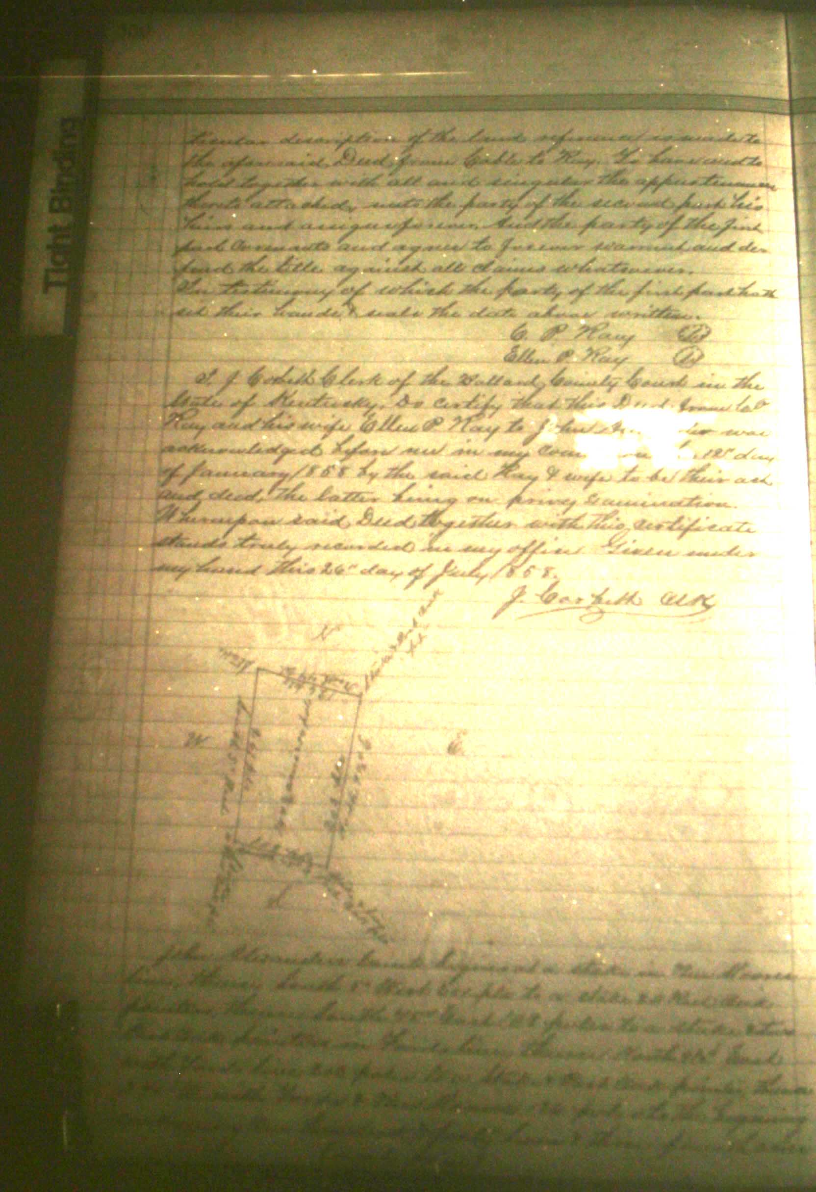